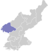
Unsan County
Unsan County is a kun, or county, in eastern North P'yŏngan province, North Korea. Within the province, it borders Hyangsan in the east, Kujang and Nyŏngbyŏn in the south, and Tongch'ang and T'aech'ŏn in the west. In addition, it is bordered by Chagang province to the east (Hŭich'ŏn) and north (Songwŏn).
Unsan County 운산군 | |
|---|---|
| Korean transcription(s) | |
| • Chosŏn'gŭl | 운산군 |
| • Hancha | 雲山郡 |
| • McCune-Reischauer | Unsan-gun |
| • Revised Romanization | Unsan-gun |
| Country | North Korea |
| Province | North P'yŏngan |
| Administrative divisions | 1 ŭp, 1 workers' district, 27 ri |
| Area | |
| • Total | 865.5 km2 (334.2 sq mi) |
Geography
The Kuryong River (구룡강) has formed a steep valley and basin in the centre of the county, into which various tributaries flow including the Uhyŏn River, Choyang River, Ryonghŭng River, and P'ungsanch'ŏn. 73% of the county's area is forested, while only 15.5% is cultivated.
Administrative divisions
Unsan county is divided into 1 ŭp (town), 1 rodongjagu (workers' district) and 27 ri (villages):
|
|
Climate
The year-round average temperature is 8.2 °C, with a January average of -10.2 °C and an August average of 23.8 °C. The climate is fairly wet, with an average annual rainfall of 1400 mm.
Economy
Of Unsan's cultivated land, most (70%) is dry-field, with numerous cattle farms; local crops include maize, soybeans, sweet potatoes, and vegetables as well as rice. Unsan leads the province in the production of sweet potatoes. Fruit is also raised. Gold and silver are mined, and factories produce textiles and ironware.
In Ryongho-ri on the slopes of Kubongsan, there are tombs from the Koguryŏ period. A tomb traditionally held to be that of the Kojosŏn ruler Wiman is also located there.
Transportation
Unsan is served by the Unsan Line of the Korean State Railway, and is also connected to neighbouring districts by road.
As of December 2016, a small runway is being installed near the Sunchon Cement Factory, believed to be intended for use by small aircraft transporting Kim Jong-un.[1]
References
- "New Kim Jong-un/executive runway under construction". North Korean Economy Watch. December 15, 2016. Archived from the original on December 17, 2016.
In this Google Earth image, we can see a new Kim Jong-un/executive runway being installed in Unsan County (은산군) Between the Sunchon Cement Factory and a large industrial construction site just south of the runway. The new runway is approximately 870 meters and is intended for small Cessna-style aircraft–similar to other runways constructed throughout the country intended for the leader.
External links
- (in Korean) In Korean language online encyclopedias:
