University of Oklahoma Westheimer Airport
University of Oklahoma Westheimer Airport (IATA: OUN, ICAO: KOUN, FAA LID: OUN) (Max Westheimer Airport) is a public use airport in Norman, in Cleveland County, Oklahoma.[1] It is owned by the University of Oklahoma.[1] The National Plan of Integrated Airport Systems for 2011–2015 categorized it as a reliever airport.[2]
University of Oklahoma Max Westheimer Airport | |||||||||||||||
|---|---|---|---|---|---|---|---|---|---|---|---|---|---|---|---|
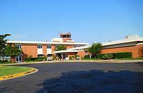
 Terminal building in 2018 | |||||||||||||||
| Summary | |||||||||||||||
| Airport type | Public | ||||||||||||||
| Owner | University of Oklahoma | ||||||||||||||
| Serves | Norman, Oklahoma | ||||||||||||||
| Elevation AMSL | 1,182 ft / 360 m | ||||||||||||||
| Coordinates | 35°14′44″N 097°28′20″W | ||||||||||||||
| Map | |||||||||||||||
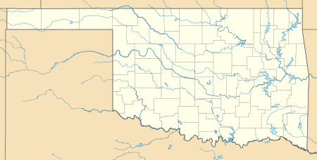
 OUN Location of airport in Oklahoma / United States  OUN OUN (the United States) | |||||||||||||||
| Runways | |||||||||||||||
| |||||||||||||||
| Statistics (2012) | |||||||||||||||
| |||||||||||||||
The Cleveland County Composite Squadron of Civil Air Patrol meets on Tuesday evenings in a hangar provided by the City of Norman, east of the terminal.
History
Built as a civil airport on land donated by the Neustadt family in the name of their uncle Max Westheimer to the University of Oklahoma and land from the city of Norman, Oklahoma, it was taken over by the U.S. Navy in 1941 and expanded as a training field. It was transferred back to the university after the war.[3]
Facilities
The airport covers 727 acres (294 ha) at an elevation of 1,182 feet (360 m). It has two asphalt runways: 18/36 is 5,199 by 100 feet (1,585 x 30 m) and 3/21 is 4,748 by 100 feet (1,447 x 30 m).[1]
In the year ended September 30, 2015, the airport had 48,700 aircraft operations, an average of 133 per day: 47,419 (97.37%) general aviation, 756 (1.55%) military, 520 (1.1%) air taxi and 5 (0.01%) air carrier operations. 105 aircraft were based at the airport: 77 (73.33%) single-engine, 20 (19%) multi-engine, and 8 (7.6%) jet. In addition to the fixed wing aircraft, eight helicopters were based at Westheimer Airport.[1]
References
- FAA Airport Master Record for OUN (Form 5010 PDF). Federal Aviation Administration. Effective November 15, 2012.
-
"2011–2015 NPIAS Report, Appendix A" (PDF). National Plan of Integrated Airport Systems. Federal Aviation Administration. October 4, 2010. Archived from the original (PDF, 2.03 MB) on September 27, 2012. External link in
|work=(help) - "OU/Max Westheimer Tower". Oklahoma Airport Operators Association. Retrieved 2014-05-08.
External links
- University of Oklahoma - Max Westheimer Airport
- University of Oklahoma Westheimer Airport (OUN) at Oklahoma Aeronautics Commission
- Cleveland County Composite Squadron - Civil Air Patrol
- University of Oklahoma LAAS & WAAS Testing
- Aerial image as of February 1995 from USGS The National Map
- FAA Airport Diagram (PDF), effective August 13, 2020
- FAA Terminal Procedures for OUN, effective August 13, 2020
- Resources for this airport:
- FAA airport information for OUN
- AirNav airport information for KOUN
- ASN accident history for OUN
- FlightAware airport information and live flight tracker
- NOAA/NWS weather observations: current, past three days
- SkyVector aeronautical chart, Terminal Procedures