Umm ar-Rasas
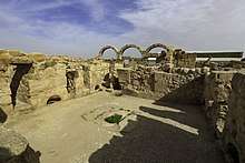
Umm ar-Rasas (Arabic: أم الرّصاص) (Kastrom Mefa'a, Kastron Mefa'a) is located 30km southeast of Madaba, which is the capital city of the Madaba Governorate in central Jordan. It was once accessible by branches of the King's Highway, and is situated in the semi-arid steppe region of the Jordanian Desert. The site has been allied to the biblical settlement of Mephaat mentioned in the Book of Jeremiah. The Roman military utilized the site as a strategic garrison, but it was later converted and inhabited by Christian and Islamic communities. In 2004, the site was inscribed as a UNESCO World Heritage Site,[1] and is valued by archaeologists for its extensive ruins dating to the Roman, Byzantine, and early Muslim periods. The Franciscan academic society in Jerusalem, Studium Biblicum Franciscanum,[2] carried out excavations at the North end of the site in 1986, but much of the area remains buried under debris.
| Um er-Rasas (Kastrom Mefa'a) | |
|---|---|
| Native name 'أم الرّصاص' | |
 | |
| Location | Amman Governorate, Jordan |
| Coordinates | 31°30′2.83″N 35°55′12.95″E |
| Elevation | 760 |
| Built | 5th Century |
| Governing body | Ministry of Tourism & Antiquities of Jordan |
| Type | Cultural |
| Criteria | i, iv, vi |
| Designated | 2004 (28th session) |
| Reference no. | 1093 |
| State Party | Jordan |
| Region | Arab States |
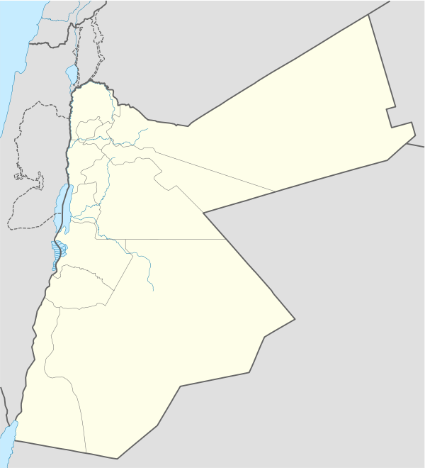
 Location of Um er-Rasas (Kastrom Mefa'a) in Jordan | |
Early history
Particularly during the epochs of the Early Bronze Age III-IV, Iron Age II, and Roman-Byzantine eras, dense populations inhabited the topographical regions beyond the western banks of the Dead Sea.[3] Among these ancient settlements, the site of Mephaat has been mentioned in biblical texts as one of the cities upon the plateau to be condemned to great destruction (Jeremiah 48:21).[4] Many branches of the King's Highway provided a means for reaching the more remote ancient cities, but the main route served as the forerunner for the Via Traiana Nova built by the Roman Emperor Trajan (53-117 A.D.).[5] This road with its many branches facilitated travel, and Roman military encampments were set in place along the way as a defensive measure against barbarian assaults across the Roman desert frontier known as the Limes Arabicus. Eusebius of Caesarea identified Mephaat as the camp site of a Roman army near the desert in his Onomasticon (K.128:21).[6] Also, the excavation of a Byzantine church here exposed an inscription naming the area as "Castron Mephaa" further supporting the theory that Umm-ar Rasas and the biblical Mephaat are one and the same.[7]
Mosaics
The most important discovery on the site was the mosaic floor of the Church of St Stephen. It was made in 785 (discovered after 1986). The perfectly preserved mosaic floor is the largest one in Jordan. On the central panel, hunting and fishing scenes are depicted, while another panel illustrates the most important cities of the region including Philadelphia (Amman), Madaba, Esbounta (Heshbon), Belemounta (Ma'an), Areopolis (Ar-Rabba), Charac Moaba (Karak), Jerusalem, Nablus, Caesarea, and Gaza. The frame of the mosaic is especially decorative. Six mosaic masters signed the work: Staurachios from Esbus, Euremios, Elias, Constantinus, Germanus, and Abdela. It overlays another, damaged, mosaic floor of the earlier (587) Church of Bishop Sergius. Another four churches were excavated nearby with traces of mosaic decoration.
Byzantine period
By the 4th century C.E., the advent of pilgrimage caused Palestine to become the nucleus of the Christian world, and scores of pious men and women traversed the desert seeking sites of scriptural significance as well as communion with their creator.[8] The number of pilgrims intensified by the 5th century C.E., and many Christians chose to settle in the desert establishing monastic communities. Umm ar-Rasas was converted into an ecclesiastical center boasting numerous Byzantine churches.[9] Among the notable finds unearthed at Umm-ar Rasas is the Church of Saint Stephen, which features elaborate and sophisticated mosaics. The discovery of Greek inscriptions within the mosaics confirmed dating to 756-785 C.E.[10] The date range coincides with the Abbasid Caliphate period of Muslim rule, and demonstrates Christian occupation later than surrounding areas.[10] The mosaics illustrate municipal vignettes with explanatory text covering a series of cities in Palestine, Jordan, and along the Nile Delta.[11] Absent from the mosaics at Umm ar-Rasas are portrayals of principal holy places revered by pilgrims such as Bethlehem, Hebron or Nazareth unlike the Madaba Map found nearby.
Muslim conquest

Muslim armies penetrated Palestine during the summer of 634 C.E., and initially assaulted regions along the Mediterranean coast including the Gaza Strip.[12] Discontented with Byzantine control, local Arab-speaking tribesmen living in the desert expanses willingly aided the Muslim invaders easing their conquest. The efficacious campaign was characterized by limited destruction, and many cities of the Holy Land surrendered on terms to Muslim rule.[13] Byzantine churches were infrequently transformed into mosques, but especially during the Abbasid period, the Muslim government actively enforced restrictive laws against Christian images.[13] Mosaics were defaced by the removal and reassembly of colored tessarrae (Tessera) as shown at the Church of Saint Stephen at Umm ar-Rasas. Following the Muslim victory, Christians continued to make pilgrimages to holy places, however, the numbers declined with the threat of imprisonment by Muslim officials.[14] Many of the monasteries and churches built by Byzantine Christians were ultimately abandoned.
Stylite tower
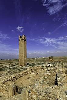
The salient feature of Umm ar-Rasas stands about 1 mile (1.6 km) north of the walled ruins.[15] Interpreted to be a Stylite tower, the soaring structure served as a platform for Christian ascetics living in isolation at the top as well as an altar for a call to prayer.[16] Ornamented with carved Christian symbols on all four sides, the square pillar endures in the distance as evidence of the once flourishing community established in the Byzantine era as a center for spiritual enlightenment.
Gallery
-114809.jpg) restoration work on Tower in 2017
restoration work on Tower in 2017-114836.jpg) interior mosaics
interior mosaics-114820.jpg) arch from an oblique angle
arch from an oblique angle
See also
References
- https://whc.unesco.org/en/list/1093
- "Archived copy". Archived from the original on 2007-12-05. Retrieved 2007-10-29.CS1 maint: archived copy as title (link)
- Dearman (1997), p. 205
- May & Metzger (1977)
- Dearman (1997), p. 206
- Timm (2010), p. 477
- Dearman (1997), p. 210
- Wilken (1988), p. 216
- Britt (2015), p. 260
- Wilken (1988), p. 236
- Bowersock (2006), pp. 11–13
- Wilken (1988), p. 234
- Schick (1988), p. 220
- Schick (1988), p. 239
- Wilken (1988), p. 217
- Ball (2000), p. 290
Bibliography
- Ball, Warwick (2000). Rome in the East: The Transformation of an Empire. New York, NY: Routledge.CS1 maint: ref=harv (link)
- Britt, Karen C. (2015). "Through a glass brightly: Christian communities in Palestine and Arabia during the early Islamic period". In Mohammad Gharipour (ed.). Sacred Precincts: The Religious Architecture of non-Muslim Communities across the Islamic World. Leiden: Brill.CS1 maint: ref=harv (link)
- Bowersock, G. W. (2006). Mosaics as History. Cambridge, MA: Harvard University Press.CS1 maint: ref=harv (link)
- Dearman, J. Andrew (1997). "Roads and settlements in Moab". The Biblical Archaeologist. 60 (4): 205–213. doi:10.2307/3210622. JSTOR 3210622.CS1 maint: ref=harv (link)
- May, Herbert G.; Metzger, Bruce M. (1977). The New Oxford Annotated Bible with the Apocrypha: Revised Standard Version, Containing the Second Edition of the New Testament and an Expanded Edition of the Apocrypha. New York, NY: Oxford University Press.CS1 maint: ref=harv (link)
- Schick, Robert (1988). "Christian life in Palestine during the early Islamic period". The Biblical Archaeologist. 51 (4): 218–221, 239–240. doi:10.2307/3210074. JSTOR 3210074.CS1 maint: ref=harv (link)
- Timm, Stefan (2010). Eusebius und die Heilige Schrift: Die Schriftvorlagen des Onomastikons der Biblischen Ortsnamen. Berlin: Walter de Gruyter.CS1 maint: ref=harv (link)
- Wilken, Robert L. (1988). "Byzantine Palestine: a Christian holy land". The Biblical Archaeologist. 51 (4): 214–217, 233–237. doi:10.2307/3210073. JSTOR 3210073.CS1 maint: ref=harv (link)
External links

- Umm ar-Rasas panoramic video