Kochkor
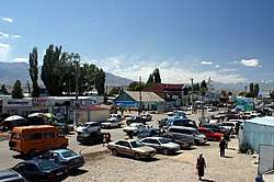
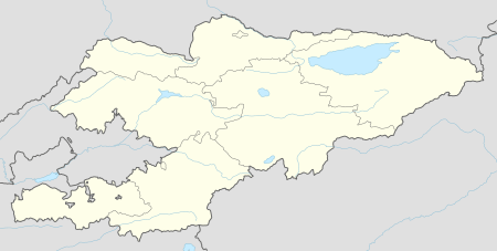
Kochkor is a large village in northern Naryn Region of Kyrgyzstan. It is the administrative centre of Kochkor District. Former names were Stolypin and Kochkorka. Altitude 1,800 m. Its population was 9,863 in 2009.[1] It is on the main A365 highway from Torugart Pass (China) north to Bishkek. About 7 km west A367 branches west toward Jalal-Abad Region and the Ferghana Valley. About 25 km northeast along the highway is the Orto-Tokoy reservoir and about 45 km northeast is Balykchy on Lake Issyk Kul. The village is a base for excursions into the high country and tourist infrastructure is fairly well developed. There is a regional museum.
Kochkor | |
|---|---|
 | |
 Kochkor | |
| Coordinates: 42°12′57″N 75°45′20″E | |
| Country | Kyrgyzstan |
| Region | Naryn Region |
| District | Kochkor District |
| Elevation | 1,767 m (5,797 ft) |
| Population (2009) | |
| • Total | 9,863 |
| Time zone | UTC +5 |
Notable people
- Turdakun Usubalijev, Soviet-era Kyrgyz politician and secretary of the Central Committee of the Communist Party of Kyrgyzstan.
gollark: The names don't actually correspond to any actual size of the transistors. So they can keep "shrinking" as long as some useful metric can be increased.
gollark: I don't think I have any configuration like /etc/network/interfaces would have been either.
gollark: My networking on here is done by NetworkManager, though I use dhcpcd or something on my servers.
gollark: This is on Arch. There is absolutely no chance that no other ones don't have it either.
gollark: ```osmarks@fenrir ~> ls /etc/network/interfacesls: cannot access '/etc/network/interfaces': No such file or directory```
References
- "2009 population census of the Kyrgyz Republic: Naryn Region" (PDF). Archived from the original (PDF) on 21 March 2012. Retrieved 2016-06-15.
This article is issued from Wikipedia. The text is licensed under Creative Commons - Attribution - Sharealike. Additional terms may apply for the media files.