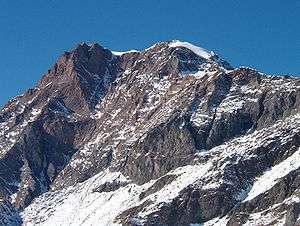
Uia di Ciamarella
Uia di Ciamarella or just Ciamarella (3,676 m) is a mountain on the border between France and Italy.
| Uia di Ciamarella | |
|---|---|
 | |
| Highest point | |
| Elevation | 3,676 m (12,060 ft) |
| Prominence | 664 m (2,178 ft) [1] |
| Listing | Alpine mountains above 3000 m |
| Coordinates | 45°19′48″N 07°08′39″E |
| Geography | |
 Uia di Ciamarella Alps | |
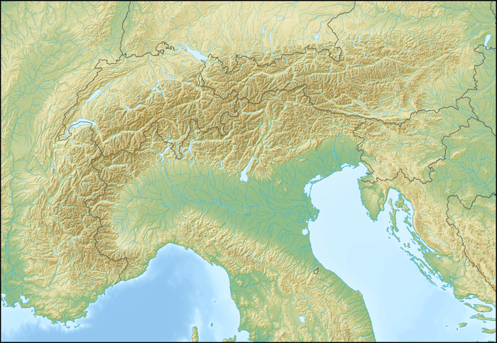
| Location | Piedmont, Italy Rhône-Alpes, France |
| Parent range | Graian Alps |
SOIUSA classification
According to the SOIUSA (International Standardized Mountain Subdivision of the Alps) the mountain can be classified in the following way:[2]
- main part = Western Alps
- major sector = North Western Alps
- section = Graian Alps
- subsection = South-Eastern Graian Alps
- supergroup = catena Arnas-Ciamarella (It) / chaîne Ouille d'Arbéon - Ciamarella (Fr)
- group = gruppo Ciamarella-Mondrone
- subgroup = sottogruppo della Ciamarella
- code = I/B-7.I-B.6.a
gollark: --choose 100 bee counterbee
gollark: --choose 100 bee counterbee
gollark: ++choose 100 6 7 8 9 10
gollark: ···
gollark: --choose 100 bee counterbee
References
- Uja di Ciamarella, Italy, web page on www.peakbagger.com (accessed on March 2012)
- Marazzi, Sergio (2005). Atlante Orografico delle Alpi. SOIUSA (in Italian). Priuli & Verlucca. p. 134. ISBN 978-88-8068-273-8.
Maps
![]()
- French official cartography (Institut géographique national - IGN); on-line version: www.geoportail.fr
- Istituto Geografico Centrale - Carta dei sentieri e dei rifugi 1:50.000 nr 2 Valli di Lanzo e Moncenisio
This article is issued from Wikipedia. The text is licensed under Creative Commons - Attribution - Sharealike. Additional terms may apply for the media files.