Ucayali Province
The Ucayali Province is one of the eight provinces in the Loreto Region of Peru. It was created on October 13, 1900, by president Eduardo López de Romaña. Its territory is mostly flat except for the Ganso Azul mountain range in its eastern part.
Ucayali | |
|---|---|
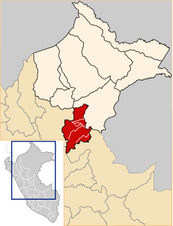 Location of Ucayali in the Loreto Region | |
| Country | Peru |
| Region | Loreto |
| Founded | October 13, 1900 |
| Capital | Contamana |
| Government | |
| • Mayor | Luis Octavio Zuta Rengifo |
| Area | |
| • Total | 29,293.47 km2 (11,310.27 sq mi) |
| Elevation | 134 m (440 ft) |
| Population | |
| • Total | 57,669 |
| • Density | 2.0/km2 (5.1/sq mi) |
| UBIGEO | 1606 |
Political division
The province is divided into six districts.
- Contamana (Contamana)
- Inahuaya (Inahuaya)
- Padre Marquez (Tiruntan)
- Pampa Hermosa (Pampa Hermosa)
- Sarayacu (Dos de Mayo)
- Vargas Guerra (Orellana)
gollark: > depending on platform endianness outside of assembly
gollark: How nice of them.
gollark: Never mind, it implements Read.
gollark: Oh DEAR, it looks like utilization of captured stout/err requires unsafe code?
gollark: No, i mean why is heavpoot utilizing C++, despite it being wrong?
References
- (in Spanish) Instituto Nacional de Estadística e Informática. Banco de Información Digital. Retrieved November 3, 2007.
| |
|---|---|
This article is issued from Wikipedia. The text is licensed under Creative Commons - Attribution - Sharealike. Additional terms may apply for the media files.