Ubinas District
Ubinas District is one of eleven districts of the province General Sánchez Cerro in the Moquegua Region in Peru.[1]
Ubinas | |
|---|---|
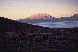 Ubinas volcano in the Ubinas District | |
| Country | |
| Region | Moquegua |
| Province | General Sánchez Cerro |
| Capital | Ubinas |
| Government | |
| • Mayor | Angel Americo Quispitupac Soto |
| Area | |
| • Total | 874.57 km2 (337.67 sq mi) |
| Elevation | 3,376 m (11,076 ft) |
| Population (2005 census) | |
| • Total | 4,804 |
| • Density | 5.5/km2 (14/sq mi) |
| Time zone | UTC-5 (PET) |
| UBIGEO | 180210 |
Geography
The highest elevation in the district is the Ubinas volcano. Other mountains are listed below:[2][3]
- Aqu Q'asa
- Chhuqu
- Hatun Urqu
- Llallawani
- Llallawi
- Llaqtayuq
- Minasniyuq
- Paru Sarayuq
- Parwayuni
- Pilluni
- Pirwani
- Puka Salla
- Pukara
- Puntayuq
- P'aqu Urqu
- Qaqawara
- Qayqu Punta
- Qucha Q'asa
- Qhuyu Parwayuni
- Q'ara Muqu
- Q'illu Q'asa
- Q'irayuq
- Sura Wañusqa
- Suri Wasi
- Ubinas
- Wit'u Pata
- Wit'uni
- Yana Qaqa
- Yuraq Kancha
- Yuraq Muqu
- Yuraq Urqu
gollark: However, English took the syllable thing, which doesn't even work the same in english, and dropped all else.
gollark: Interesting fact: Japaneseishly speaking, the syllable count makes no sense, and haikus are about other things.
gollark: What? That's a great* compliant haiku.
gollark: are correlated
gollark: that with which apioforms
References
- (in Spanish) Instituto Nacional de Estadística e Informática. Banco de Información Distrital Archived 2008-04-23 at the Wayback Machine. Retrieved April 11, 2008.
- escale.minedu.gob.pe - UGEL map of the General Sánchez Cerro Province (Moquegua Region)
- escale.minedu.gob.pe - UGEL map of the Mariscal Nieto Province (Moquegua Region)
| |
|---|---|
| General Sánchez Cerro | |
| Ilo | |
| Mariscal Nieto | |
This article is issued from Wikipedia. The text is licensed under Creative Commons - Attribution - Sharealike. Additional terms may apply for the media files.