Tuy Hoa Airport
Tuy Hoa Airport (IATA: TBB, ICAO: VVTH) (Vietnamese: Sân bay Tuy Hòa) is located just south of Tuy Hòa within the Phú Yên Province, along the central coast of southern Vietnam.
Tuy Hoa Airport Sân bay Tuy Hòa | |||||||||||||||||||
|---|---|---|---|---|---|---|---|---|---|---|---|---|---|---|---|---|---|---|---|
| Summary | |||||||||||||||||||
| Airport type | Public | ||||||||||||||||||
| Operator | Middle Airport Authority | ||||||||||||||||||
| Location | Tuy Hòa, Vietnam | ||||||||||||||||||
| Elevation AMSL | 6 m / 20 ft | ||||||||||||||||||
| Coordinates | 13°02′58″N 109°20′01″E | ||||||||||||||||||
| Website | tuyhoaairport | ||||||||||||||||||
| Map | |||||||||||||||||||
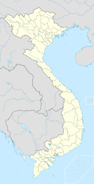 TBB Location of the airport in Vietnam | |||||||||||||||||||
| Runways | |||||||||||||||||||
| |||||||||||||||||||
It was built in 1966 for the United States Air Force as Tuy Hoa Air Base. It was used by the U.S. Air Force (1966–70) and U.S. Army (1970-71), during the Vietnam War. It was transferred to the Republic of Vietnam in 1971, and came under Communist control after the South Vietnamese collapse of 1975.
Airlines and destinations
| Airlines | Destinations |
|---|---|
| VietJet Air | Hanoi,[3] Ho Chi Minh City |
| Vietnam Airlines | Hanoi, Ho Chi Minh City[4] |
gollark: ❌ ❌ ❌ ❌ ❌ ❌ ❌ ❌ ❌ ❌ ❌ ❌ ❌ ❌ ❌ ❌ ❌ ❌ ❌ ❌ ❌ ❌ ❌ ❌ ❌ ❌ ❌ ❌ ❌ ❌ ❌ ❌ ❌ ❌ ❌ ❌ ❌ ❌ ❌ ❌ ❌ ❌ ❌ ❌ ❌ ❌ ❌ ❌ ❌ ❌ ❌ ❌ ❌ ❌ ❌ ❌ ❌ ❌ ❌ ❌ ❌ ❌ ❌ ❌ ❌ ❌ ❌ ❌ ❌ ❌ ❌ ❌ ❌ ❌ ❌ ❌ ❌ ❌ ❌ ❌ ❌ ❌ ❌ ❌ ❌ ❌ ❌ ❌ ❌ ❌ ❌ ❌ ❌ ❌ ❌ ❌ ❌ ❌ ❌ ❌ ❌ ❌ ❌ ❌ ❌ ❌ ❌ ❌ ❌ ❌ ❌ ❌ ❌ ❌ ❌ ❌ ❌ ❌ ❌ ❌ ❌ ❌ ❌ ❌ ❌ ❌ ❌ ❌ ❌ ❌ ❌ ❌ ❌ ❌ ❌ ❌ ❌ ❌ ❌ ❌ ❌ ❌ ❌ ❌ ❌ ❌ ❌ ❌ ❌ ❌ ❌ ❌ ❌ ❌ ❌ ❌ ❌ ❌ ❌ ❌ ❌ ❌ ❌ ❌ ❌ ❌ ❌ ❌ ❌ ❌ ❌ ❌ ❌ ❌ ❌ ❌ ❌ ❌ ❌ ❌ ❌ ❌ ❌ ❌ ❌ ❌ ❌ ❌ ❌ ❌ ❌ ❌ ❌ ❌ ❌ ❌ ❌ ❌ ❌ ❌ ❌ ❌ ❌ ❌ ❌ ❌ ❌ ❌
gollark: ❌ ❌ ❌ ❌ ❌ ❌ ❌ ❌ ❌ ❌ ❌ ❌ ❌ ❌ ❌ ❌ ❌ ❌ ❌ ❌ ❌ ❌ ❌ ❌ ❌ ❌ ❌ ❌ ❌ ❌ ❌ ❌ ❌ ❌ ❌ ❌ ❌ ❌ ❌ ❌ ❌ ❌ ❌ ❌ ❌ ❌ ❌ ❌ ❌ ❌ ❌ ❌ ❌ ❌ ❌ ❌ ❌ ❌ ❌ ❌ ❌ ❌ ❌ ❌ ❌ ❌ ❌ ❌ ❌ ❌ ❌ ❌ ❌ ❌ ❌ ❌ ❌ ❌ ❌ ❌ ❌ ❌ ❌ ❌ ❌ ❌ ❌ ❌ ❌ ❌ ❌ ❌ ❌ ❌ ❌ ❌ ❌ ❌ ❌ ❌ ❌ ❌ ❌ ❌ ❌ ❌ ❌ ❌ ❌ ❌ ❌ ❌ ❌ ❌ ❌ ❌ ❌ ❌ ❌ ❌ ❌ ❌ ❌ ❌ ❌ ❌ ❌ ❌ ❌ ❌ ❌ ❌ ❌ ❌ ❌ ❌ ❌ ❌ ❌ ❌ ❌ ❌ ❌ ❌ ❌ ❌ ❌ ❌ ❌ ❌ ❌ ❌ ❌ ❌ ❌ ❌ ❌ ❌ ❌ ❌ ❌ ❌ ❌ ❌ ❌ ❌ ❌ ❌ ❌ ❌ ❌ ❌ ❌ ❌ ❌ ❌ ❌ ❌ ❌ ❌ ❌ ❌ ❌ ❌ ❌ ❌ ❌ ❌ ❌ ❌ ❌ ❌ ❌ ❌ ❌ ❌ ❌ ❌ ❌ ❌ ❌ ❌ ❌ ❌ ❌ ❌ ❌ ❌
gollark: ❌ ❌ ❌ ❌ ❌ ❌ ❌ ❌ ❌ ❌ ❌ ❌ ❌ ❌ ❌ ❌ ❌ ❌ ❌ ❌ ❌ ❌ ❌ ❌ ❌ ❌ ❌ ❌ ❌ ❌ ❌ ❌ ❌ ❌ ❌ ❌ ❌ ❌ ❌ ❌ ❌ ❌ ❌ ❌ ❌ ❌ ❌ ❌ ❌ ❌ ❌ ❌ ❌ ❌ ❌ ❌ ❌ ❌ ❌ ❌ ❌ ❌ ❌ ❌ ❌ ❌ ❌ ❌ ❌ ❌ ❌ ❌ ❌ ❌ ❌ ❌ ❌ ❌ ❌ ❌ ❌ ❌ ❌ ❌ ❌ ❌ ❌ ❌ ❌ ❌ ❌ ❌ ❌ ❌ ❌ ❌ ❌ ❌ ❌ ❌ ❌ ❌ ❌ ❌ ❌ ❌ ❌ ❌ ❌ ❌ ❌ ❌ ❌ ❌ ❌ ❌ ❌ ❌ ❌ ❌ ❌ ❌ ❌ ❌ ❌ ❌ ❌ ❌ ❌ ❌ ❌ ❌ ❌ ❌ ❌ ❌ ❌ ❌ ❌ ❌ ❌ ❌ ❌ ❌ ❌ ❌ ❌ ❌ ❌ ❌ ❌ ❌ ❌ ❌ ❌ ❌ ❌ ❌ ❌ ❌ ❌ ❌ ❌ ❌ ❌ ❌ ❌ ❌ ❌ ❌ ❌ ❌ ❌ ❌ ❌ ❌ ❌ ❌ ❌ ❌ ❌ ❌ ❌ ❌ ❌ ❌ ❌ ❌ ❌ ❌ ❌ ❌ ❌ ❌ ❌ ❌ ❌ ❌ ❌ ❌ ❌ ❌ ❌ ❌ ❌ ❌ ❌ ❌
gollark: ❌ ❌ ❌ ❌ ❌ ❌ ❌ ❌ ❌ ❌ ❌ ❌ ❌ ❌ ❌ ❌ ❌ ❌ ❌ ❌ ❌ ❌ ❌ ❌ ❌ ❌ ❌ ❌ ❌ ❌ ❌ ❌ ❌ ❌ ❌ ❌ ❌ ❌ ❌ ❌ ❌ ❌ ❌ ❌ ❌ ❌ ❌ ❌ ❌ ❌ ❌ ❌ ❌ ❌ ❌ ❌ ❌ ❌ ❌ ❌ ❌ ❌ ❌ ❌ ❌ ❌ ❌ ❌ ❌ ❌ ❌ ❌ ❌ ❌ ❌ ❌ ❌ ❌ ❌ ❌ ❌ ❌ ❌ ❌ ❌ ❌ ❌ ❌ ❌ ❌ ❌ ❌ ❌ ❌ ❌ ❌ ❌ ❌ ❌ ❌ ❌ ❌ ❌ ❌ ❌ ❌ ❌ ❌ ❌ ❌ ❌ ❌ ❌ ❌ ❌ ❌ ❌ ❌ ❌ ❌ ❌ ❌ ❌ ❌ ❌ ❌ ❌ ❌ ❌ ❌ ❌ ❌ ❌ ❌ ❌ ❌ ❌ ❌ ❌ ❌ ❌ ❌ ❌ ❌ ❌ ❌ ❌ ❌ ❌ ❌ ❌ ❌ ❌ ❌ ❌ ❌ ❌ ❌ ❌ ❌ ❌ ❌ ❌ ❌ ❌ ❌ ❌ ❌ ❌ ❌ ❌ ❌ ❌ ❌ ❌ ❌ ❌ ❌ ❌ ❌ ❌ ❌ ❌ ❌ ❌ ❌ ❌ ❌ ❌ ❌ ❌ ❌ ❌ ❌ ❌ ❌ ❌ ❌ ❌ ❌ ❌ ❌ ❌ ❌ ❌ ❌ ❌ ❌
gollark: ❌ ❌ ❌ ❌ ❌ ❌ ❌ ❌ ❌ ❌ ❌ ❌ ❌ ❌ ❌ ❌ ❌ ❌ ❌ ❌ ❌ ❌ ❌ ❌ ❌ ❌ ❌ ❌ ❌ ❌ ❌ ❌ ❌ ❌ ❌ ❌ ❌ ❌ ❌ ❌ ❌ ❌ ❌ ❌ ❌ ❌ ❌ ❌ ❌ ❌ ❌ ❌ ❌ ❌ ❌ ❌ ❌ ❌ ❌ ❌ ❌ ❌ ❌ ❌ ❌ ❌ ❌ ❌ ❌ ❌ ❌ ❌ ❌ ❌ ❌ ❌ ❌ ❌ ❌ ❌ ❌ ❌ ❌ ❌ ❌ ❌ ❌ ❌ ❌ ❌ ❌ ❌ ❌ ❌ ❌ ❌ ❌ ❌ ❌ ❌ ❌ ❌ ❌ ❌ ❌ ❌ ❌ ❌ ❌ ❌ ❌ ❌ ❌ ❌ ❌ ❌ ❌ ❌ ❌ ❌ ❌ ❌ ❌ ❌ ❌ ❌ ❌ ❌ ❌ ❌ ❌ ❌ ❌ ❌ ❌ ❌ ❌ ❌ ❌ ❌ ❌ ❌ ❌ ❌ ❌ ❌ ❌ ❌ ❌ ❌ ❌ ❌ ❌ ❌ ❌ ❌ ❌ ❌ ❌ ❌ ❌ ❌ ❌ ❌ ❌ ❌ ❌ ❌ ❌ ❌ ❌ ❌ ❌ ❌ ❌ ❌ ❌ ❌ ❌ ❌ ❌ ❌ ❌ ❌ ❌ ❌ ❌ ❌ ❌ ❌ ❌ ❌ ❌ ❌ ❌ ❌ ❌ ❌ ❌ ❌ ❌ ❌ ❌ ❌ ❌ ❌ ❌ ❌
References
- Airport information for VVTH at Great Circle Mapper.
- Airport information for Tuy Hoa Airport at Transport Search website.
- "Vietjet Air Adds New Domestic Routes from May 2016". airlineroute. Retrieved 28 April 2016.
- "Vietnam Airlines đồng loạt mở thêm nhiều đường bay nội địa mới". Vietnam Airlines (in Vietnamese). Retrieved 1 June 2020.
This article is issued from Wikipedia. The text is licensed under Creative Commons - Attribution - Sharealike. Additional terms may apply for the media files.