Tungku (village)
Tungku, locally known in Malay as Kampung Tungku or Kampong Tungku, is a village administrative division in Brunei-Muara District of Brunei. It is one of the village subdivisions under the mukim or subdistrict Gadong 'A'. The community of Tungku is jointly administered with that of Katok where both are headed by a ketua kampung or village head; the incumbent is Ismail bin Rajab.[1] Tungku is also a designated postcode area with the postcode is BE2119.[2][3]
Tungku Kampung Tungku Kampong Tungku | |
|---|---|
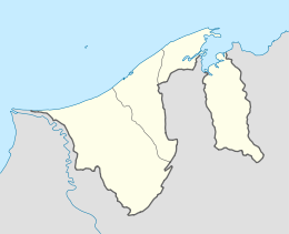
 Location in Brunei | |
| Coordinates: 4°55′25.8″N 114°53′23.5″E | |
| Country | Brunei |
| District | Brunei-Muara |
| Subdistrict | Gadong 'A' |
| Government | |
| • Village head | Ismail bin Rajab |
| Postcode | BE2119 |
Geography
Tungku borders the village subdivisions of Rimba, Rimba National Housing Area 1 and Area 5 and Rimba Landless Indigenous Citizens' Housing Scheme to the east; Tungku Landless Indigenous Citizens' Housing Scheme Area 1 and Area 2 to the south-east; Katok and Katok 'A' Landless Indigenous Citizens' Housing Scheme to the south; and Peninjau to the west. The north borders with the South China Sea.
See also
- Tungku Landless Indigenous Citizens' Housing Scheme Area 1
- Tungku Landless Indigenous Citizens' Housing Scheme Area 2
- Tungku Landless Indigenous Citizens' Housing Scheme Area 3
References
- "FAPW participants visit Madu Kelulut farm in Kg Tungku – Borneo Bulletin Online". Borneo Bulletin Online. 2017-03-14. Retrieved 2018-02-17.
- "Brunei Postal Services - postcodes". post.gov.bn. Retrieved 2018-02-17.
- "Kampong Tungku, Gadong, Brunei Muara: BE2119 | Brunei Postcode". brn.postcodebase.com. Retrieved 2018-02-17.