Tsaliet
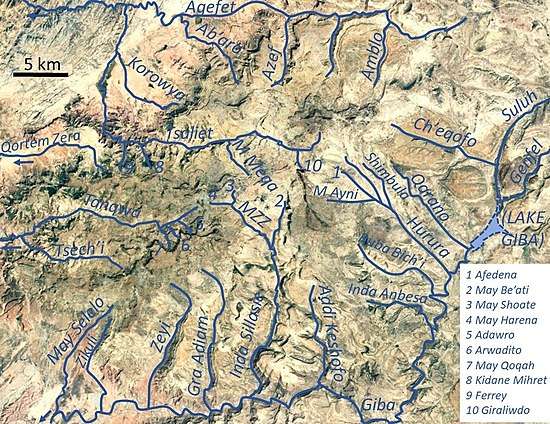
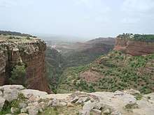
Tsaliet is a river in northern Ethiopia, belonging to the Nile basin. Rising in the mountains of Dogu’a Tembien, where it is first called May Leiba River and then Tinsehe River, it flows westward through a deep gorge, to become Tsaliet in its lower course, where it empties in Weri’i River, just upstream of the main Weri’i bridge along the road to Adwa.[1]
| Tsaliet | |
|---|---|
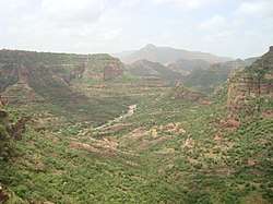 The Tsaliet River near Dabba Selama monastery | |
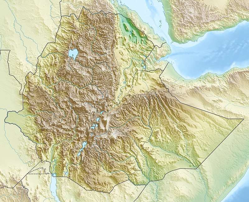 Tsaliet River in Tigray Region | |
| Location | |
| Country | Ethiopia |
| Region | Tigray Region |
| Physical characteristics | |
| Source | Tegula'i |
| • location | Ayninbirkekin municipality |
| • elevation | 2,512 m (8,241 ft) |
| Mouth | Weri'i River |
• location | 10 km N of Werqamba |
• coordinates | 13.844°N 39.006°E |
• elevation | 1,380 m (4,530 ft) |
| Length | 45 km (28 mi) |
| Width | |
| • average | 50 m (160 ft) |
| Basin features | |
| River system | Permanent river |
| Landmarks | Dabba Selama monastery, Arebay mountain, Haddinnet ridge, Welegesa rock church |
| Tributaries | |
| • left | Graliwdo, May Meqa, Kidane Mihret, Ferrey[1] |
| • right | Korowya, Agefet |
| Waterbodies | May Leiba reservoir, Kolu Ba’alti pond |
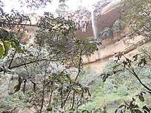
| Waterfalls | Tinsehe |
| Bridges | Addeha (road Werqamba-Hawzien); Ruba Weyni (rural road) |
| Topography | Mountains and deep gorges |
Characteristics
It is mostly a confined river, locally meandering in its narrow alluvial plain, with an average slope gradient of 25 metres per kilometre. With its tributaries, the river has cut deep gorges. Along the middle of its course, it occupies sandy pediments in Addeha.[2]
Flash floods and flood buffering
Runoff mostly happens in the form of high runoff discharge events that occur in a very short period (called flash floods). These are related to the steep topography, often little vegetation cover and intense convective rainfall. The peaks of such flash floods have often a 50 to 100 times larger discharge than the preceding baseflow.[2] The magnitude of floods in this river has however been decreased due to interventions in its upper catchment, particularly around the May Leiba reservoir. Physical conservation structures such as stone bunds[3][4] and check dams intercept runoff.[5][6] On many steep slopes, exclosures have been established; the dense vegetation largely contributes to enhanced infiltration, less flooding and better baseflow.[7] Examples are the Khunale exclosure and the Harehuwa exclosure.
Irrigated agriculture
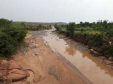
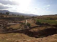
Besides springs and reservoirs, irrigation is strongly dependent on the river's baseflow. Such irrigated agriculture is important in meeting the demands for food security and poverty reduction.[2] Irrigated lands are established in the narrow alluvial plains along the river in:[1]
- large lowland irrigation schemes with tropical fruits in Addeha
- spring-based irrigation in Ruba Weyni
Transhumance towards the gorge
The valley bottoms in the gorges of this river have been identified as transhumance destination zones. Transhumance takes place in the summer rainy season, when the lands near the villages are occupied by crops. Young shepherds will take the village cattle down to the gorge and overnight in small caves. The gorges are particularly attractive as a transhumance destination zone, because there is water and good growth of semi-natural vegetation.[8]
Geology
Tsaliet Group
The Tsaliet Group, an older sequence of metamorphic rock is named after the Tsaliet River.[9] Based on crystallisation ages of its rocks in Eritrea and Ethiopia, it is estimated that the igneous activity occurred between ∼850 and 740 million years ago. The Tsaliet Group has recorded the arc volcanism and the formation of crust that later formed part of the Arabian-Nubian Shield.[10] The Group consists of partially metamorphosed volcanic and sedimentary rocks (impure marble, slate, calcareous siltstone, sericite-chlorite schist, greywacke, and tuff), with a minimum thickness between 1500 and 2500 metres.[11][9]
Boulders and pebbles in the river bed
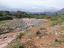
From upstream to downstream, the following lithological units occur in the catchment.[9]
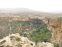
- Antalo Limestone
- Quaternary freshwater tufa[12]
- Adigrat Sandstone
- Edaga Arbi Glacials
- Tsaliet metamorphic rock
Logically, in the uppermost stretches of the river, only the pebbles and boulders of the upper lithological units will be present in the river bed, whereas more downstream one may find a more comprehensive mix of all lithologies crossed by the river.
Natural boundary
During its course, this river passes through two woredas and constitutes their boundary over some six kilometres.[1] On the various parts:
- Dogu’a Tembien to the southeast
- Kola Tembien to the northwest
Trekking along the river
Trekking routes have been established across and along this river.[13] The tracks are not marked on the ground but can be followed using downloaded .GPX files.[14]
- Trek 3 follows the river course
- Trek 21 runs at half height on the flanks of the Tsaliet gorge in Haddinnet
- Treks 23 and 26 round the upper catchment
In the rainy season, flash floods may occur and it is advised not to follow the river bed. At times it may be impossible to cross the river in the rainy season.[15]
See also
- List of Ethiopian rivers
References
- Jacob, M. and colleagues (2019). Geo-trekking map of Dogu'a Tembien (1:50,000). In: Geo-trekking in Ethiopia's Tropical Mountains - The Dogu'a Tembien District. SpringerNature. ISBN 978-3-030-04954-6.
- Amanuel Zenebe, and colleagues (2019). The Giba, Tanqwa and Tsaliet rivers in the headwaters of the Tekezze basin. In: Geo-trekking in Ethiopia's Tropical Mountains - The Dogu'a Tembien District. SpringerNature. doi:10.1007/978-3-030-04955-3_14. ISBN 978-3-030-04954-6.
- Nyssen, Jan; Poesen, Jean; Gebremichael, Desta; Vancampenhout, Karen; d'Aes, Margo; Yihdego, Gebremedhin; Govers, Gerard; Leirs, Herwig; Moeyersons, Jan; Naudts, Jozef; Haregeweyn, Nigussie; Haile, Mitiku; Deckers, Jozef (2007). "Interdisciplinary on-site evaluation of stone bunds to control soil erosion on cropland in Northern Ethiopia". Soil and Tillage Research. 94 (1): 151–163. doi:10.1016/j.still.2006.07.011. hdl:1854/LU-378900.
- Gebeyehu Taye and colleagues (2015). "Evolution of the effectiveness of stone bunds and trenches in reducing runoff and soil loss in the semi-arid Ethiopian highlands". Zeitschrift für Geomorphologie. 59 (4): 477–493. doi:10.1127/zfg/2015/0166.
- Nyssen, J.; Veyret-Picot, M.; Poesen, J.; Moeyersons, J.; Haile, Mitiku; Deckers, J.; Govers, G. (2004). "The effectiveness of loose rock check dams for gully control in Tigray, Northern Ethiopia". Soil Use and Management. 20: 55–64. doi:10.1111/j.1475-2743.2004.tb00337.x.
- Etefa Guyassa and colleagues (2017). "Effects of check dams on runoff characteristics along gully reaches, the case of Northern Ethiopia". Journal of Hydrology. 545 (1): 299–309. doi:10.1016/j.jhydrol.2016.12.019.
- Descheemaeker, K. and colleagues (2006). "Runoff on slopes with restoring vegetation: A case study from the Tigray highlands, Ethiopia". Journal of Hydrology. 331 (1–2): 219–241. doi:10.1016/j.still.2006.07.011.
- Nyssen, Jan; Descheemaeker, Katrien; Zenebe, Amanuel; Poesen, Jean; Deckers, Jozef; Haile, Mitiku (2009). "Transhumance in the Tigray highlands (Ethiopia)". Mountain Research and Development. 29 (3): 255–264. doi:10.1659/mrd.00033.
- Sembroni, A.; Molin, P.; Dramis, F. (2019). Regional geology of the Dogu'a Tembien massif. In: Geo-trekking in Ethiopia's Tropical Mountains — The Dogu'a Tembien District. SpringerNature. ISBN 978-3-030-04954-6.
- Abbate, E., Bruni, P., & Sagri, M. (2015). Geology of Ethiopia: a review and geomorphological perspectives. In: Billi, P. (ed.), Landscapes and Landforms of Ethiopia (pp. 33-64). Springer Netherlands https://link.springer.com/chapter/10.1007/978-94-017-8026-1_2
- Tefera, M., Chernet, T., Haro, W., 1996. Geological Map of Ethiopia (1:2,000,000). Ethiopian Institute of Geological Survey. Addis Ababa, Ethiopia
- Moeyersons, J. and colleagues (2006). "Age and backfill/overfill stratigraphy of two tufa dams, Tigray Highlands, Ethiopia: Evidence for Late Pleistocene and Holocene wet conditions". Palaeogeography, Palaeoclimatology, Palaeoecology. 230 (1–2): 162–178. Bibcode:2006PPP...230..165M. doi:10.1016/j.palaeo.2005.07.013.
- Description of trekking routes in Dogu'a Tembien. In: Geo-trekking in Ethiopia's Tropical Mountains - The Dogu'a Tembien District. SpringerNature. 2019. ISBN 978-3-030-04954-6.
- https://www.openstreetmap.org/traces/tag/nyssen-jacob-frankl
- Nyssen, Jan (2019). "Logistics for the Trekker in a Rural Mountain District of Northern Ethiopia". Geo-trekking in Ethiopia's Tropical Mountains. GeoGuide. Springer-Nature. pp. 537–556. doi:10.1007/978-3-030-04955-3_37. ISBN 978-3-030-04954-6.