Trinity Inlet
The Trinity Inlet is an oceanic inlet which serves as the port for the city of Cairns, Queensland, Australia. The city centre is on the western bank where the inlet meets the Coral Sea.[1]
| Trinity Inlet | |
|---|---|
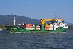
 The MV Trinity Bay steaming out of Trinity Inlet. | |
 Trinity Inlet Location in Queensland | |
| Location | Cairns, Queensland |
| Coordinates | 16°55′12″S 145°47′04″E |
| Type | Inlet |
| Etymology | Trinity Sunday |
| Part of | Trinity Bay |
| River sources | Mossman River |
| Ocean/sea sources | Coral Sea, South Pacific Ocean |
| Basin countries | Australia |
| Settlements | Cairns |
Location and features
In prehistoric times, the Trinity Inlet was the river mouth of the Mulgrave River.[2] Volcanic activity resulted in the rise of Green Hill in the Mulgrave Valley, but contrary to popular belief this did not block the river, as sediments continued to build up over the volcanic rocks.[3] The Mulgrave River later shifted course and now empties into the Coral Sea 30 kilometres (19 mi) further south at the southern extremity of the Yarrabah Hills range.
Trinity Inlet is lined with mangroves and mudflats. Within the inlet a large mud island has been formed and was given the name Admiralty Island. Concerns have been raised about the amount of debris and derelict shipping that exist in the upper regions of the inlet.[4]
Commercially the inlet provides a limited deep-water berthing for the port of Cairns, allowing the export of cane sugar. The region's only tanker berth and the Royal Australian Navy base HMAS Cairns are located on the inlet. Several shipbuilders and tour operators that visit the Great Barrier Reef operate from the Reef Terminal on the entrance to the inlet.[5]
Remnants of a levee can be found on the eastern bank opposite Cairns. This was an effort by CSR in the 1970s to cultivate sugar cane on mostly intertidal land previously occupied by mangroves and saltmarsh. This was not successful due to the disturbance of a large area of acid sulfate soil. Discharge of sulfuric acid into Trinity inlet from this land resulted in a number of fish kills. In recent years, the Queensland Government has undertaken a major remediation project to prevent the acid discharge and rehabilitate the land behind the levee.
The inlet offers shelter to small vessels when tropical cyclones threaten. A commercial saltwater crocodile farm is in operation on the upper reaches, though wild examples are still very rare in the area after hunting in the early 20th century.
References
- "Trinity Inlet".
- "www.ga.gov.au/image_cache/GA4166.pdf" (PDF). Archived from the original (PDF) on 11 September 2007.
- Nott, Jonathan F. (2003). "The urban geology of Cairns, Queensland, Australia". Quaternary International (abstract). 103: 75–82. doi:10.1016/S1040-6182(02)00142-8.
- "Who is taking care of Trinity Inlet ? :: ABC Far North Qld".
- "Cairns Esplanade Reef Fleet Terminal - Great Barrier Reef Cruises - Cairns Australia".