Tribby Peak
Tribby Peak (71°56′S 97°48′W) is a peak 1.5 nautical miles (2.8 km) west of Mount Bubier on Edwards Peninsula, Thurston Island. It was named by the Advisory Committee on Antarctic Names (US-ACAN) after Osborne M. Tribby, the Pharmacist's Mate in the Eastern Group of U.S. Navy Operation Highjump and an aircrewman on the PBM Mariner flight to Noville Peninsula on January 11–12, 1947, in which survivors of the December 30 PBM crash were rescued and returned to the seaplane tender Pine Island.
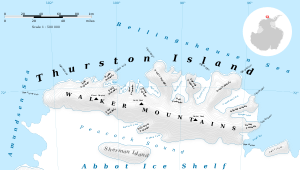
Map of Thurston Island.
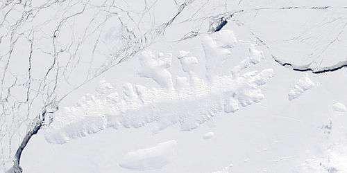
Satellite image of Thurston Island.
Maps
- Thurston Island – Jones Mountains. 1:500000 Antarctica Sketch Map. US Geological Survey, 1967.
- Antarctic Digital Database (ADD). Scale 1:250000 topographic map of Antarctica. Scientific Committee on Antarctic Research (SCAR). Since 1993, regularly upgraded and updated.
![]()
![]()
gollark: ↑
gollark: !time <@!258639553357676545>
gollark: additionalize the eomojitron
gollark: ÆÆÆÆÆÆÆÆÆÆÆÆÆÆÆÆÆÆÆÆÆÆÆÆÆÆÆ
gollark: It's webp.
This article is issued from Wikipedia. The text is licensed under Creative Commons - Attribution - Sharealike. Additional terms may apply for the media files.