Treinta y Tres
Treinta y Tres (Spanish pronunciation: [ˈtɾejnta i ˈtɾes]) is the capital city of the Treinta y Tres Department in eastern Uruguay.
Treinta y Tres | |
|---|---|
Capital city | |
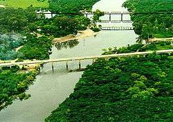
 Bridges over the River Olimar | |
 Coat of arms | |
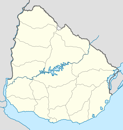
 Treinta y Tres Location in Uruguay | |
| Coordinates: 33°14′0″S 54°23′0″W | |
| Country | |
| Department | |
| Population (2011 Census) | |
| • Total | 25,477 |
| • Demonym | olimareño,-a |
| Time zone | UTC -3 |
| Postal code | 33000 |
| Dial plan | +598 445 (+5 digits) |
| Climate | Cfa |
Location

The city is located on Route 8, on the north banks of Olimar Grande River. The city is almost surrounded by a populated rural area, a zone of chacras (ranches), known as Ejido de Treinta y Tres.
History
Its name means "Thirty Three" and refers to the 19th-century national heroes, the 33 Orientales, who established the independence of Uruguay. Coincidentally, the city is located near the 33°S line of latitude, making the name doubly appropriate.
On 10 March 1853 it was declared a "Pueblo" (village) by the Act of Ley Nº 307 and on 20 September 1884 it was made capital of the department created by Ley Nº 1.754. According to the Act of Ley Nº 3.544, on 19 July 1909 it held the status of "Villa" (town), which was elevated to "Ciudad" (city) on 29 September 1915 by the Act of Ley 5.335.[1]
Population
In 2011, Treinta y Tres had a population of 25,477.[2] It is by far the largest town in what is a sparsely populated department. Together with Ejido de Treinta y Tres and the southwestern suburb of Villa Sara, they form a population centre of around 33,000 inhabitants.
|
| |||||||||||||||||||||||||||
| Source: Instituto Nacional de Estadística de Uruguay[1] | ||||||||||||||||||||||||||||
Places of worship
- St. Joseph the Worker Parish Church (Roman Catholic)
- Parish Church of Our Lady of the Thirty-Three (Roman Catholic)
- Parish Church of the Holy Savior (Roman Catholic)
Notable people
- Emiliano Alfaro - footballer
- Gonzalo Lemes - footballer
- Darío Silva - footballer
- Octavio Rivero - footballer
Climate
The climate in this area is characterized by hot, humid summers and generally mild to cool winters. According to the Köppen Climate Classification system, Treinta y Tres has a humid subtropical climate, abbreviated "Cfa" on climate maps.[3]
| Climate data for Treinta y Tres (1980–2009) | |||||||||||||
|---|---|---|---|---|---|---|---|---|---|---|---|---|---|
| Month | Jan | Feb | Mar | Apr | May | Jun | Jul | Aug | Sep | Oct | Nov | Dec | Year |
| Record high °C (°F) | 41.1 (106.0) |
40.5 (104.9) |
40.2 (104.4) |
36.4 (97.5) |
31.2 (88.2) |
28.6 (83.5) |
31.2 (88.2) |
31.0 (87.8) |
35.0 (95.0) |
34.7 (94.5) |
39.7 (103.5) |
41.5 (106.7) |
41.5 (106.7) |
| Average high °C (°F) | 30.2 (86.4) |
29.1 (84.4) |
27.6 (81.7) |
24.0 (75.2) |
20.0 (68.0) |
17.0 (62.6) |
16.7 (62.1) |
18.6 (65.5) |
19.8 (67.6) |
23.0 (73.4) |
25.7 (78.3) |
28.5 (83.3) |
23.4 (74.1) |
| Daily mean °C (°F) | 23.9 (75.0) |
23.2 (73.8) |
21.8 (71.2) |
18.4 (65.1) |
14.6 (58.3) |
12.1 (53.8) |
11.7 (53.1) |
13.2 (55.8) |
14.4 (57.9) |
17.4 (63.3) |
19.7 (67.5) |
22.1 (71.8) |
17.7 (63.9) |
| Average low °C (°F) | 17.6 (63.7) |
17.4 (63.3) |
16.1 (61.0) |
12.8 (55.0) |
9.3 (48.7) |
7.2 (45.0) |
6.7 (44.1) |
7.8 (46.0) |
8.9 (48.0) |
11.7 (53.1) |
13.7 (56.7) |
15.7 (60.3) |
12.1 (53.8) |
| Record low °C (°F) | 1.8 (35.2) |
4.5 (40.1) |
2.0 (35.6) |
−1.2 (29.8) |
−2.8 (27.0) |
−7.6 (18.3) |
−4.6 (23.7) |
−4.0 (24.8) |
−4.2 (24.4) |
−1.2 (29.8) |
1.4 (34.5) |
1.0 (33.8) |
−7.6 (18.3) |
| Average precipitation mm (inches) | 104.3 (4.11) |
132.1 (5.20) |
109.6 (4.31) |
132.7 (5.22) |
133.2 (5.24) |
131.8 (5.19) |
118.9 (4.68) |
112.9 (4.44) |
106.1 (4.18) |
109.2 (4.30) |
110.6 (4.35) |
107.6 (4.24) |
1,408.9 (55.47) |
| Average precipitation days (≥ 1.0 mm) | 6 | 7 | 5 | 5 | 6 | 6 | 6 | 7 | 7 | 6 | 6 | 5 | 72 |
| Average relative humidity (%) | 70 | 74 | 76 | 79 | 81 | 83 | 81 | 79 | 77 | 75 | 72 | 70 | 76 |
| Mean monthly sunshine hours | 266.6 | 214.7 | 220.1 | 183.0 | 170.5 | 132.0 | 145.7 | 164.3 | 174.0 | 210.8 | 240.0 | 263.5 | 2,385.2 |
| Mean daily sunshine hours | 8.6 | 7.6 | 7.1 | 6.1 | 5.5 | 4.4 | 4.7 | 5.3 | 5.8 | 6.8 | 8.0 | 8.5 | 6.5 |
| Source 1: Instituto Nacional de Investigación Agropecuaria[4] | |||||||||||||
| Source 2: Dirección Nacional de Meteorología (precipitation days 1961–1990, extremes 1939–1994)[5][6] | |||||||||||||
References
- "Statistics of urban localities (1908–2004)" (PDF). INE. 2012. Retrieved 6 September 2012.
- "Censos 2011 Cuadros Trenta y Tres". INE. 2012. Archived from the original on 10 October 2012. Retrieved 25 August 2012.
- Climate Summary for Treinta y Tres, Uruguay
- Castaño, José; Giménez, Agustín; Ceroni, Mauricio; Furest, José; Aunchayna, Rossina. "Caracterización Agroclimática del Uruguay 1980–2009" (PDF) (in Spanish). Instituto Nacional de Investigación Agropecuaria. Archived from the original (PDF) on 12 December 2018. Retrieved 15 December 2018.
- "Estadísticas climatológicas : Estacion Meteorologica Treinta y tres" (in Spanish). Dirección Nacional de Meteorología. Archived from the original on November 30, 2014. Retrieved May 8, 2013.
- "RECORDS METEOROLOGICOS EN EL URUGUAY" (in Spanish). Dirección Nacional de Meteorología. Retrieved May 8, 2014.
