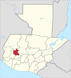
Totonicapán Department
Totonicapán is one of the 22 departments of Guatemala. The capital is the city of Totonicapán.
Totonicapán Department Departmento de Totonicapán | |
|---|---|
 Flag  Coat of arms | |
 Totonicapán | |
| Coordinates: 14°54′45″N 91°21′36″W | |
| Country | |
| Capital | Totonicapán |
| Municipalities | 8 |
| Government | |
| • Type | Departmental |
| Area | |
| • Department of Guatemala | 1,061 km2 (410 sq mi) |
| Population (2018)[1] | |
| • Department of Guatemala | 418,569 |
| • Density | 390/km2 (1,000/sq mi) |
| • Urban | 204,938 |
| • Ethnicities | K'iche' people, Ladino |
| • Religions | Roman Catholicism, Evangelicalism, Maya |
| Time zone | UTC-6 |
| ISO 3166 code | GT-TO |
History
Historical chronicler Francisco Antonio de Fuentes y Guzmán, described the municipalities of Totonicapán in his 1689 “Recordación Florida.” This record confirms the area's pre-Columbian origins.
In July, 1820, the indigenous residents of Totonicapán revolted against the government in response to excessive tributes imposed by the Spanish King Ferdinand VII. The rebellion was led by Atanasio Tzul and Lucas Aguilar. After toppling the local government, Tzul declared himself king of the breakaway province, with Aguilar as president. The mayor of neighboring Quetzaltenango, Prudencio Cózar, along with hundreds of armed men, led an invasion to put down the rebellion. The rebel government lasted about 20 days. The rebels were captured, whipped, and imprisoned.
The rebellion is widely celebrated in Guatemala as the opening volley in the independence struggle, though more recent scholarship on the rebellion has suggested that its leaders were less concerned with breaking from the Spanish Crown than they were concerned with the unfair demands of the American born Spanish elite, or criollos.
Geography
Totonicapán has an area of 1,061 km² located in the western highlands. Its territory is crossed by ramifications of the Sierra Madre, and includes mountains as Cuxniquel, Campanabaj, and Cerro de Coxóm. Important rivers in Totonicapaán include the Samalá, Pachac, Las Palmeras, Sajcocolaj, Patzotzil, Huacol and Pajá.
The department is widely recognized in Central America for its extensive highland oak-pine forests with also fir and cypress stands, these hold some of the largest stands of the threatened Guatemalan fir, Abies guatemalensis, known locally as the pinabete. The forests cover extensive portions of the Sierra Madre, especially in the municipios of San Francisco el Alto and Totonicapán, and are held in a variety of communal arrangements, including village, clan (parcialidad) and municipio-wide ownership.
Demographics
Population
The National Institute of Statistics of Guatemala estimated the population of Totonicapán to be 418,569 in 2018, down from 506,537 in 2013.
The male/female ratio of the department is 47.7/52.3, and as is true for Guatemala as a whole, Totonicapán has a relatively young population, with a median age of 16 (nationally it is only 17).[2]
Government
Municipalities
Economy
As of 1850, the department produced wheat, maize, sugar, fruits, and vegetables. Livestock is raised the area.[3]
Transportation
Cuatro Caminos ("four roads") is a well-known intersection of roads that go to Quetzaltenango, Guatemala City, Huehuetenango and Totonicapán.
References
- Citypopulation.de Population of departments in Guatemala
- "Caracterización departamental: Totonicapán 2013" (PDF). Caracterización departamental: Totonicapán 2013. Instituto Nacional de Estadística (INE). 2014. Retrieved 1 August 2015.
- Baily, John (1850). Central America; Describing Each of the States of Guatemala, Honduras, Salvador, Nicaragua, and Costa Rica. London: Trelawney Saunders. p. 85.