Topoľovka
Topoľovka is a village and municipality in Humenné District in the Prešov Region of north-east Slovakia.
Topoľovka | |
|---|---|
Village | |
.jpg) Main street in Topoľovka, the centre of village. Buildings on the left are the commune council building with civil registry and rural market | |
 Topoľovka Location of Topoľovka in Slovakia | |
| Coordinates: 48°55′10″N 21°48′30″E | |
| Country | Slovakia |
| Region | Prešov Region |
| District | Humenné District |
| First mentioned | 1479 |
| Area | |
| • Total | 7.787 km2 (3.007 sq mi) |
| Elevation | 157 m (515 ft) |
| Population (31 December 2005) | |
| • Total | 824 |
| • Density | 110/km2 (270/sq mi) |
| Time zone | UTC+1 (CET) |
| • Summer (DST) | UTC+2 (CEST) |
| Postal code | 066 45 |
| Area code(s) | 421-57 |
| Car plate | HE |
| Website | https://web.archive.org/web/20111002193458/http://www.topolovka.sk/ |
History
In historical records the village was first mentioned in 1479.
Geography
The municipality lies at an altitude of 157 metres (515 feet) and covers an area of 7.777 square kilometres (3.003 square miles). It has a population of about 825 people.
International relations
gollark: If you engage in large quantities of capitalism we could purchase TLDs, but this would be annoying.
gollark: And people would complain.
gollark: And hijacking the actual root DNS system would probably take at least 3.
gollark: This is true.
gollark: We could also just something something OpenNIC.
External links
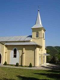
A Roman Catholic church in the village
This article is issued from Wikipedia. The text is licensed under Creative Commons - Attribution - Sharealike. Additional terms may apply for the media files.