Todenroth
Todenroth is an Ortsgemeinde – a municipality belonging to a Verbandsgemeinde, a kind of collective municipality – in the Rhein-Hunsrück-Kreis (district) in Rhineland-Palatinate, Germany. It belongs to the Verbandsgemeinde of Kirchberg, whose seat is in the like-named town.
Todenroth | |
|---|---|
 Coat of arms | |
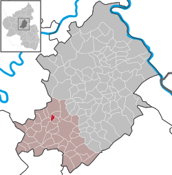
Location of Todenroth within Rhein-Hunsrück-Kreis district  | |
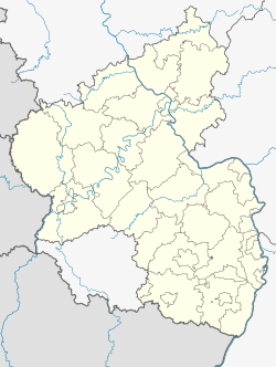
 Todenroth  Todenroth | |
| Coordinates: 49°58′37″N 7°21′24″E | |
| Country | Germany |
| State | Rhineland-Palatinate |
| District | Rhein-Hunsrück-Kreis |
| Municipal assoc. | Kirchberg |
| Government | |
| • Mayor | Hans Dietrich |
| Area | |
| • Total | 1.56 km2 (0.60 sq mi) |
| Elevation | 390 m (1,280 ft) |
| Population (2018-12-31)[1] | |
| • Total | 81 |
| • Density | 52/km2 (130/sq mi) |
| Time zone | CET/CEST (UTC+1/+2) |
| Postal codes | 55481 |
| Dialling codes | 06763 |
| Vehicle registration | SIM |


Geography
Location
The municipality lies in the central Hunsrück roughly 5 km northwest of Kirchberg. Todenroth's municipal area measures 1.56 km², of which 0.36 km² is wooded.
History
Roman archaeological finds have been unearthed east of the village on the way to Metzenhausen. Two coins (“grand bronze”) are from Antonius Pius’s reign (138-161). The reverse shows a standing woman with the mark SC. Another "grand bronze" coin from Hadrian's reign (117-138). The reverse shows a standing Diana with the SC. In District 1 of the municipal forest, a Roman bronze basin was found. It has a diameter of 24 cm and adornment.
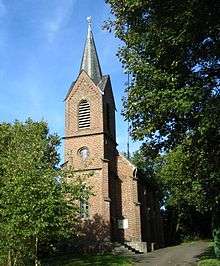
In 1310, Todenroth had its first documentary mention in a taxation register kept by the Counts of Sponheim. In 1312, a document mentioned a man named Kunemann von Todenroth. The 1438 directory of holdings mentioned two Sponheim estates in Todenroth. Beginning in 1794, Todenroth lay under French rule. In 1815 it was assigned to the Kingdom of Prussia at the Congress of Vienna. The Evangelical church, a Gothic Revival aisleless church, was built in 1894. Since 1946, Todenroth has been part of the then newly founded state of Rhineland-Palatinate.[2]
Religion
The Evangelical parish of Todenroth, to which Kludenbach and Metzenhausen also belonged, merged in 1978 with the Evangelical parish of Ober Kostenz.
Politics
Municipal council
The council is made up of 6 council members, who were elected by majority vote at the municipal election held on 7 June 2009, and the honorary mayor as chairman.[3]
Mayor
Todenroth's mayor is Hans Dietrich, and his deputy is Karl Heinz Faller.[4]
Coat of arms
The German blazon reads: In Blau eine eingeschweifte goldene Spitze, darin drei schwarze Mühlräder 1 : 2. Vorn eine goldene Kirche. Hinten drei goldene Ähren.
The municipality's arms might in English heraldic language be described thus: Tierced in mantle, dexter azure a church affronty Or, sinister azure three ears of rye of the second and in base Or three waterwheels spoked of eight sable, two and one.
From the early 14th century, Todenroth is witnessed as a holding of the Counts of Sponheim. The tinctures azure and Or (blue and gold), which were the ones borne in the Counts’ “chequy” coat of arms, are a reference to the village's former allegiance to the “Further” County of Sponheim. The church on the dexter (armsbearer's right, viewer's left) side refers to the one that towers over the village. The ears of rye (called simply Ähren in the German blazon, or “ears”, but in English heraldry, at least, would be held to be rye because the ears droop[5]) on the sinister (armsbearer's left, viewer's right) side refer to the municipality's former agricultural character. The waterwheels refer to the three mills that were once in the village, in the Kyrbach valley.[6]
Culture and sightseeing
Buildings
The following are listed buildings or sites in Rhineland-Palatinate’s Directory of Cultural Monuments:[7]
- Evangelical church, Zum Hasenberg – Gothic Revival brick aisleless church, 1894
Economy and infrastructure
Transport
Running by some two kilometres north of Todenroth is Bundesstraße 327, while two kilometres to the east is Bundesstraße 421.
Todenroth lies within the area served by the Verkehrsverbund Rhein-Mosel (VRM, Rhine-Moselle Transport Association). The Rheinhunsrückbus route 633 offers links to the nearby town of Kirchberg on schooldays. The nearest railway stations are Bullay on the Koblenz–Trier railway (25 km away), Emmelshausen on the Hunsrückbahn (28 km away) and Kirn on the Nahe Valley Railway (30 km away).
References
- "Bevölkerungsstand 2018 - Gemeindeebene". Statistisches Landesamt Rheinland-Pfalz (in German). 2019.
- Todenroth’s history
- Der Landeswahlleiter Rheinland-Pfalz: Kommunalwahl 2009, Stadt- und Gemeinderatswahlen
- Todenroth’s council
- James Parker on heraldic grains
- Description and explanation of Todenroth’s arms
- Directory of Cultural Monuments in Rhein-Hunsrück district