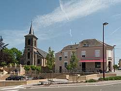
Tintigny
Tintigny is a Walloon municipality located in the Virton arrondissement in the Belgian province of Luxembourg. On 1 January 2015 the municipality had 4,200 inhabitants.[2] Its total area is 81.79 km², giving it a population density of 45.7 inhabitants per km².
Tintigny | |
|---|---|
 | |
 Flag .svg.png) Coat of arms | |
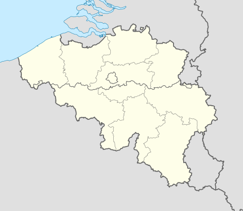 Tintigny Location in Belgium
Location of Tintigny in Luxembourg province 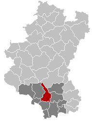 | |
| Coordinates: 49°41′N 05°31′E | |
| Country | Belgium |
| Community | French Community |
| Region | Wallonia |
| Province | Luxembourg |
| Arrondissement | Virton |
| Government | |
| • Mayor | Philippe Labranche |
| • Governing party/ies | RIC |
| Area | |
| • Total | 81.79 km2 (31.58 sq mi) |
| Population (2018-01-01)[1] | |
| • Total | 4,276 |
| • Density | 52/km2 (140/sq mi) |
| Postal codes | 6730 |
| Area codes | 063 |
| Website | (in French) www.tintigny.be |
The municipality consists of the following sub-municipalities: Tintigny proper, Bellefontaine, Rossignol, and Saint-Vincent. Other population centers include Ansart, Breuvanne, Han, Lahage, and Poncelle.
References
- "Wettelijke Bevolking per gemeente op 1 januari 2018". Statbel. Retrieved 9 March 2019.
- "Chiffres de population au 1er janvier 2015" (PDF). Belgian Interior Ministry. Retrieved October 16, 2018.
External links

Places adjacent to Tintigny | |
|---|---|
Municipalities of Luxembourg Province | ||
|---|---|---|
| Arlon |  | |
| Bastogne | ||
| Marche-en-Famenne | ||
| Neufchâteau | ||
| Virton | ||
This article is issued from Wikipedia. The text is licensed under Creative Commons - Attribution - Sharealike. Additional terms may apply for the media files.