Ticaboo, Utah
Ticaboo (/ˈtɪkəbuː/ TIK-ə-boo) is an unincorporated community in far southeastern Garfield County, Utah, United States.[1]
Ticaboo, Utah | |
|---|---|
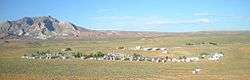 Image of Ticaboo, with Mt. Ellsworth in the background, May 2008 | |
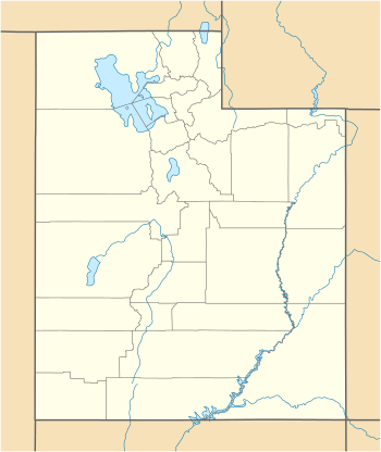 Ticaboo Location of Ticaboo within the State of Utah  Ticaboo Ticaboo (the United States) | |
| Coordinates: 37°40′30″N 110°41′48″W | |
| Country | United States |
| State | Utah |
| County | Garfield |
| Founded | 1977 |
| Founded by | A. Roy May |
| Government - Utilities are managed by Ticaboo Utility Improvement District | |
| • Type | Local Improvement District |
| • TUID CEO & District Manager | Chip Shortreed |
| • Master Development Lease Holder | Ticaboo Resort, LLC |
| Elevation | 4,265 ft (1,300 m) |
| Time zone | UTC-7 (Mountain (MST)) |
| • Summer (DST) | UTC-6 (MDT) |
| ZIP codes | 84533 |
| Area code(s) | 435 |
| GNIS feature ID | 1434980[1] |
Description
The community lies along State Route 276 more than 90 miles (140 km) east of Panguitch, the county seat of Garfield County.[2][3] Its elevation is 4,265 feet (1,300 m).[1] Although it is unincorporated, it has a post office, with the ZIP code of 84533.[4] Ticaboo gets its name from Ticaboo Creek, which was named by Cass Hite in the 1880s, from a Paiute word meaning "friendly".[5]
History

The Ticaboo townsite is a master-planned community that was organized in the late 1970s to both provide housing to the then booming uranium mining industry in southeastern Garfield County, and tap into the tourism potential of nearby Lake Powell. The Ticaboo Resort was developed to provide accommodations to guests visiting the remote area as well as to encourage the development of a tourism base outside of Bullfrog in the northern Lake Powell area.[6]
The first inhabitants of Ticaboo were Kayenta Anasazi. In October 1981, the Division of Utah State History conducted an excavation of a small settlement known as the Ticaboo Town Ruins, located directly west of the town of Ticaboo.[7]
Ticaboo Resort is one of many master development lease holders tasked with the development of Ticaboo by the Utah School and Trust Lands Administration (SITLA). Previous master development lease holders have included mining companies who also owned mines in the Henry Mountain Complex, or the Shootaring Mill. Established in 1977, Plateau Resources Limited was the master development lease holder[8] and constructed the infrastructure that still exists today for electric, water, and wastewater.
Trail of the Ancients
Ticaboo is on Utah State Route 276, which is a part of the Trail of the Ancients National Scenic Byway.
See also
![]()
References
- "Ticaboo". Geographic Names Information System. United States Geological Survey.
- "MyTopo Maps - Ticaboo, UT, USA" (Map). mytopo.com. Trimble Navigation, Ltd. Retrieved 19 Mar 2018.
- Rand McNally. 'The Road Atlas '08. Chicago: Rand McNally, 2008, pp. 102, 103.
- Zip Code Lookup
- Van Cott, John W. (1990). Utah Place Names: A Comprehensive Guide to the Origins of Geographic Names: A Compilation. Salt Lake City: University of Utah Press. p. 370. ISBN 978-0-87480-345-7. OCLC 797284427.
- http://udn.lib.utah.edu/cdm/compoundobject/collection/gcn5/id/18545/show/18555/rec/35
- https://archive.org/stream/archaeologicalin00fike#page/n183/mode/2up/search/ticaboo
- http://udn.lib.utah.edu/cdm/compoundobject/collection/gcn5/id/11677/show/11686/rec/1
External links
| Wikimedia Commons has media related to Ticaboo, Utah. |
- Ticaboo at Garfield County Office of Tourism
Municipalities and communities of Garfield County, Utah, United States | ||
|---|---|---|
| Cities | 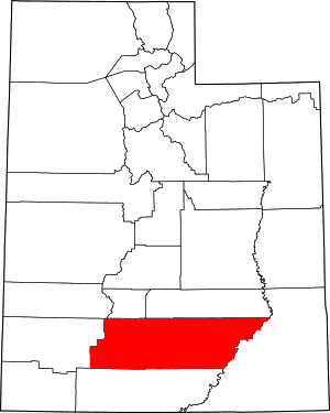 Map of Utah highlighting Garfield County | |
| Towns | ||
| Unincorporated communities | ||
| Ghost towns | ||