Thoroton
Thoroton is a small English parish in the borough of Rushcliffe, Nottinghamshire, with a population of 112.[1] The village has conservation area status. Its parish church is a Grade I listed building.
| Thoroton | |
|---|---|
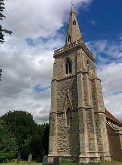 St Helena's Church, Thoroton: the church tower and steeple | |
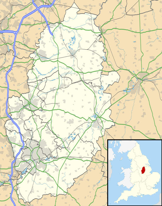 Thoroton Location within Nottinghamshire | |
| Population | 112 (2011) |
| OS grid reference | SK764425 |
| District | |
| Shire county | |
| Region | |
| Country | England |
| Sovereign state | United Kingdom |
| Post town | NOTTINGHAM |
| Postcode district | NG13 |
| Dialling code | 01949 |
| Police | Nottinghamshire |
| Fire | Nottinghamshire |
| Ambulance | East Midlands |
| UK Parliament | |
Geography
Thoroton lies along the banks of the River Smite, about 15 miles (24 km) east of Nottingham, 4 miles (6.4 km) north-east of Bingham and adjacent to Scarrington, Hawksworth, Sibthorpe, Orston and Aslockton. It is bounded by an originally Roman road, the Fosse Way – A46 – 3 miles (4.8 km) to the west, the A1 3 miles (4.8 km) to the east, and the A52 2 miles (3.2 km) further south.
Thoroton belongs under Rushcliffe Borough Council. Since December 2019, the member of Parliament for the Rushcliffe constituency, to which Thoroton belongs, is the Conservative Ruth Edwards.[2]
Heritage
Thoroton and was granted conservation area status in 1974. It is served by the medieval Anglican St Helena's Church, which is a Grade I listed building.[3] There is a service held once a month.[4]
The place name seems to contain an Old Norse personal name Þurferð + tūn (Old English), an enclosure; a farmstead; a village; an estate; thus "Farm of a man called Thurferth".[5] There are 19 such place names (Scandinavian personal name followed by tūn ) in Nottinghamshire, all of them in the Domesday survey, and all apparently ancient villages.[6]
Charles Falconer, Baron Falconer of Thoroton takes his name from part of his wife's name, whose family home is near Thoroton.[7] The Falconers also own property in the village itself, which is let.
Transport
Thoroton is served by buses to Bottesford, Bingham and nearby villages on Tuesdays and to Newark-on-Trent, Bottesford and nearby villages on Wednesdays.[8]
The nearest railway station is at Aslockton (2.2 miles/3.5 km). It offers regular services between Nottingham and Grantham or Skegness.[9]
Amenities
The nearest primary school to the village is at Orston (2 miles/3.5 km). Secondary education is available in Bingham and Newark-on-Trent.
There are shopping, medical and other services at Newark-on-Trent (9 miles/14.5 km), Bingham (6 miles/10 km) and Bottesford (5 miles/8 km). The nearest public houses are the Cranmer Arms in Aslockton (2 miles/3.2 km) and the Durham Ox in Orston. Both serve meals, as does Orston's Limehaus café.[10][11][12] Accommodation is available in Bingham and Elton on the Hill (4 miles/6.5 km).
References
- "Civil parish 2011". Neighbourhood Statistics. Office for National Statistics. Retrieved 16 April 2016.
- Rushcliffe result. Retrieved 5 January 2020.
- List of listeds Retrieved 19 July 2018.
- A Church Near You Retrieved 31 July 2016.
- J. Gover, A. Mawer and F. M. Stenton (eds.), Place Names of Nottinghamshire (Cambridge, 1940), p. 229; A. D. Mills, Dictionary of English Place-Names (Oxford, 2002), p. 345; E. Ekwall, Concise Oxford Dictionary of English Place-names (Oxford, 1960), p. 229.
- J. Gover et al., p. xviii.
- The Domesday bloke, The Guardian, Retrieved 3 August 2015
- Bus times Retrieved 16 July 2018.
- Trainline Retrieved 16 July 2018.
- Retrieved 16 July 2018.
External links
![]()