Texas barrier islands
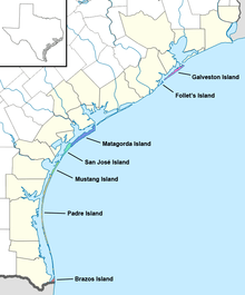
The Texas barrier islands are a chain of barrier islands in the Gulf of Mexico along the coast of Texas. The islands enclose a series of estuaries along the Texas coast and attract tourists for activities such as recreational fishing and dolphin watching. The seven barrier islands, listed from northeast to southwest, are Galveston Island, Follet's Island, Matagorda Island, San José Island, Mustang Island, Padre Island, and Brazos Island.[1]
Padre Island is the world's largest barrier island, with a length of 113 miles (182 km).[1] Since 1962 Padre Island has been divided in two by the dredging of the Port Mansfield Channel roughly 30 miles (48 km) north of the south end of the island, which separated it into portions referred to as South Padre Island and North Padre Island.[2]
List of islands
| Latitude | Name | Length | Estuary | Map |
|---|---|---|---|---|
| 29°13' N | Galveston Island | 27 miles (43 km) | Trinity–San Jacinto Estuary (Galveston Bay) | 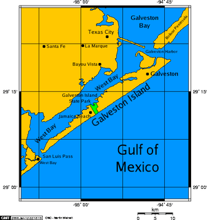 |
| 29°2' N | Follet's Island | 13 miles (21 km) | Christmas Bay Estuary | 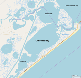 |
| 28°14' N | Matagorda Island | 38 miles (61 km) | Guadalupe Estuary (San Antonio Bay) | 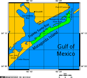 |
| 27°59' N | San José Island | 21 miles (34 km) | Mission–Aransas Estuary (Aransas Bay) | 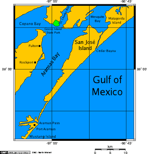 |
| 27°44' N | Mustang Island | 18 miles (29 km) | Nueces Estuary (Corpus Christi Bay) | 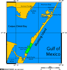 |
| 26°50' N | Padre Island | 113 miles (182 km) | Laguna Madre Estuary | 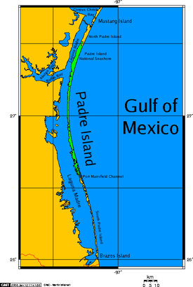 |
| 26°2' N | Brazos Island | 4.0 miles (6.4 km) | Laguna Madre Estuary | 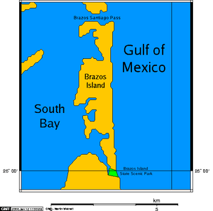 |
References
- Weddle, Robert S. "Gulf of Mexico". Handbook of Texas Online. Texas State Historical Association. Retrieved March 24, 2020.
- Leatherwood, Art. "Port Mansfield Channel". Handbook of Texas Online. Texas State Historical Association. Retrieved March 24, 2020.
External links
