Texas State Highway Loop 368
Loop 368 is a 8.115-mile-long (13.060 km) loop route in the U.S. state of Texas that follows a former route of U.S. Highway 81 (US 81) in San Antonio. Loop 368 follows Broadway Street from Interstate 35 (I-35) northeast of Downtown San Antonio towards the northeast and follows Austin Highway before ending near the interchange of I-35 and I-410 in Fratt. The road is still a major arterial for the city, providing access to Brackenridge Park, the San Antonio Zoo and the University of the Incarnate Word.
| ||||
|---|---|---|---|---|
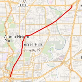
Loop 368 highlighted in red | ||||
| Route information | ||||
| Length | 8.115 mi[1] (13.060 km) | |||
| Existed | 1962–present | |||
| Major junctions | ||||
| South end | ||||
| North end | ||||
| Highway system | ||||
| ||||

History
Loop 368 follows the original routing of US 81 on the northeast side of San Antonio.[1] US 81 was first designated along this stretch in 1927 and is the basis of the naming of the road Austin Highway due to US 81 passing through Austin northeast of San Antonio.[2] On August 1, 1962, when US 81 was rerouted onto the freeway to the east, the old segment was designated as Loop 368, but signed as Business U.S. 81. Once U.S. 81 was decommissioned, it's now signed only as Loop 368. On December 18, 2014, the section from Burr Road in Alamo Heights to IH-35 was planned to be removed from the state highway system as part of TxDOT's San Antonio turnback program, which gave 21.8 miles of roads to the city.[3] This section will be cancelled when the project on the deleted section is complete.[1][4] The original turnback proposal would have turned back over 129 miles and would have also decommissioned the section of Loop 368 from the McNay Art Museum entrance northeast of New Braunfels Avenue to I-35, but the city of San Antonio said no to that proposal.[5][6]
Route description
Loop 368 begins northeast of Downtown San Antonio at I-35 near the U.S. Highway 281/I-35/I-37 interchange. The loop heads northeast along Broadway Street through Midtown San Antonio, passing to the east of Brackenridge Park, the San Antonio Zoo and the University of the Incarnate Word. The road continues towards the northeast passing through the cities of Alamo Heights and Terrell Hills. At an intersection of Broadway Street and Austin Highway, Loop 368 begins to follow Austin Highway towards the northeast. The highway continues to the northeast to its northern terminus at the interchange of I-35 and I-410.[7]
Junction list
The entire route is in Bexar County.
| Location | mi[7] | km | Destinations | Notes | |
|---|---|---|---|---|---|
| San Antonio | 0.0 | 0.0 | |||
| Fratt | 8.1 | 13.0 | I-410 west exit 26, east exit 26A | ||
| 1.000 mi = 1.609 km; 1.000 km = 0.621 mi | |||||
References
- Transportation Planning and Programming Division (n.d.). "State Highway Loop No. 368". Highway Designation Files. Texas Department of Transportation. Retrieved 2008-02-23.
- Transportation Planning and Programming Division (n.d.). "U.S. Highway No. 81". Highway Designation Files. Texas Department of Transportation. Retrieved 2008-02-23.
- https://www.mysanantonio.com/news/local/article/San-Antonio-approves-switch-in-road-maintenance-5189753.php. Missing or empty
|title=(help) - "December 2014 meeting". Missing or empty
|url=(help) - https://www.expressnews.com/news/local/article/City-officials-say-no-to-TxDOT-turnback-program-4997151.php. Missing or empty
|title=(help) - https://sanantonio.legistar.com/LegislationDetail.aspx?ID=1520507&GUID=2B8D75CC-ED18-4C40-8C17-6B871569CC03. Missing or empty
|title=(help) - Google (2008-02-22). "overview map of Loop 368" (Map). Google Maps. Google. Retrieved 2008-02-22.