Texas State Highway 217
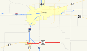
State Highway 217 (SH 217) is a Texas state highway running from Canyon east to the Palo Duro Canyon State Park where it becomes Texas Park Road 5. The route was designated on May 29, 1935.[2]
| ||||
|---|---|---|---|---|
 | ||||
| Route information | ||||
| Maintained by TxDOT | ||||
| Length | 13.587 mi[1] (21.866 km) | |||
| Existed | 1935–present | |||
| Major junctions | ||||
| West end | ||||
| East end | ||||
| Highway system | ||||
| ||||

Junction list
The entire route is in Randall County.
| Location | mi | km | Destinations | Notes | |
|---|---|---|---|---|---|
| Canyon | |||||
| I-27 exit 106. | |||||
| | FM 1541 Spur | ||||
| | |||||
| | |||||
| 1.000 mi = 1.609 km; 1.000 km = 0.621 mi | |||||
gollark: I'll counterhack them with IPv8, don't worry.
gollark: You may need to counterhack it with the blockchain.
gollark: Just use tetris-mode with emacs.
gollark: Then, open a virtual backdoor through the cloud with CSS.
gollark: So, first, you need to SSH into the cyberMatrix.
References
- Transportation Planning and Programming Division (n.d.). "State Highway No. 217". Highway Designation Files. Texas Department of Transportation. Retrieved 2008-04-03.
- (PDF) https://publicdocs.txdot.gov/minord/MinuteOrderDocLib/003673872.pdf. Missing or empty
|title=(help)
This article is issued from Wikipedia. The text is licensed under Creative Commons - Attribution - Sharealike. Additional terms may apply for the media files.