Telkibánya
Telkibánya is a village in Borsod-Abaúj-Zemplén county, in the Northern Hungary region of northeastern Hungary.
Telkibánya | |
|---|---|
Village | |
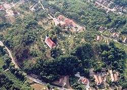 Aerial photography of Telkibánya | |
 Flag  Coat of arms | |
 Telkibánya Location of Telkibánya in Hungary | |
| Coordinates: 48.4829°N 21.3566°E | |
| Country | Hungary |
| Region | Northern Hungary |
| County | Borsod-Abaúj-Zemplén |
| Government | |
| • Mayor | Lászlóné Mester |
| Area | |
| • Total | 46.82 km2 (18.08 sq mi) |
| Population (2015)[2] | |
| • Total | 549 |
| • Density | 12/km2 (30/sq mi) |
| Time zone | UTC+1 (CET) |
| • Summer (DST) | UTC+2 (CEST) |
| Postal code | 3896 |
| Area code | +36 46 |
| Website | https://telkibanya.hu/ |
Geography
It covers an area of 46.82 km2 (18 sq mi) and has a population of 549 people (2015).[2]
Main Sights
- Protestant cemetery and church
- St. Catherine zion
- Mining Museum
- Ruins of Koncfalva
- Ice cave
- Mining pits and former gold washing claims
- Surface minerals
- Surface perlite flow
Gallery
- Photos of Telkibánya
 Protestant cemetery
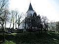 Protestant church
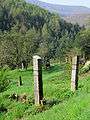
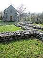 runes and St. Catherine zion
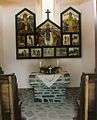 Altar of St. Catherine painted by Zoltán Joó
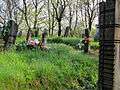 Cemetery at the Protestant church
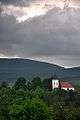 Protestant church from the Bizsóka
 Unitarist church front
gollark: No, it's the string 11.
gollark: You mean java*script*, right?
gollark: It's more of a thing of "badly designed but also widely used everywhere so you get lots of insanity".
gollark: My server is, luckily, entirely PHP-free.
gollark: https://eev.ee/blog/2012/04/09/php-a-fractal-of-bad-design/There's the good old fractal of bad design listing some other PHPisms.
References
- Telkibánya at the Hungarian Central Statistical Office (Hungarian).
- Gazetteer of Hungary, 1st January 2015. Hungarian Central Statistical Office. 3 September 2015
External links
| Wikimedia Commons has media related to Telkibánya. |


This article is issued from Wikipedia. The text is licensed under Creative Commons - Attribution - Sharealike. Additional terms may apply for the media files.