Tekolďany
Tekolďany is a village and municipality in Hlohovec District in the Trnava Region of western Slovakia.
Tekolďany | |
|---|---|
Municipality | |
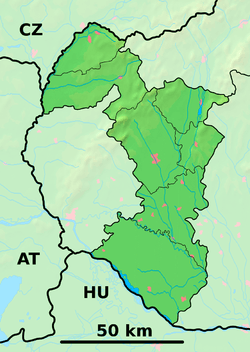
 Tekolďany Location of Tekolďany in the Trnava Region  Tekolďany Tekolďany (Slovakia) | |
| Coordinates: 48°30′N 17°54′E | |
| Country | Slovakia |
| Region | Trnava |
| District | Hlohovec |
| First mentioned | 1310 |
| Area | |
| • Total | 2.598 km2 (1.003 sq mi) |
| Elevation | 210 m (690 ft) |
| Population | |
| • Total | 165 |
| • Density | 64/km2 (160/sq mi) |
| Postal code | 920 62 (pošta Horné Otrokovce) |
| Area code(s) | +421-33 |
| Car plate | HC |
History
In historical records the village was first mentioned in 1310.
Geography
The municipality lies at an altitude of 210 metres and covers an area of 2.598 km2 (1 sq mi). It has a population of about 165 people.
gollark: Under the HTech™ and PotatOS privacy policies, we MAY harvest any information whatsoever from you for any reason, see.
gollark: Did you know? All will vote in favour of my proposal, or they will not have voted in favour of my proposal.
gollark: Fascinating.
gollark: Idea: make helloboi all moderators simultaneously.
gollark: Who hath pinged me?
This article is issued from Wikipedia. The text is licensed under Creative Commons - Attribution - Sharealike. Additional terms may apply for the media files.