Teegaon
Teegaon is a Gram Panchayat village in Pandhurna Tehsil of Chhindwara district in the Indian state of Madhya Pradesh.
Teegaon तिगांव | |
|---|---|
village | |
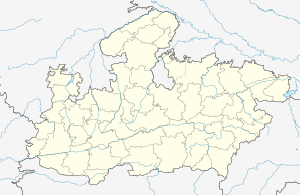
 Teegaon Location in Madhya Pradesh, India  Teegaon Teegaon (India) | |
| Coordinates: 21°38′36″N 78°27′34″E | |
| Country | |
| State | Madhya Pradesh |
| District | Chhindwara |
| Government | |
| • Type | Gram Parishad |
| • Body | Gram Panchayat Teegaon |
| • Sarpanch | Domuji Warthi |
| Area | |
| • Total | 7.2 km2 (2.8 sq mi) |
| Elevation | 484 m (1,588 ft) |
| Population (2011) | |
| • Total | 7,785 |
| • Density | 1,100/km2 (2,800/sq mi) |
| Language | |
| • Official | Hindi |
| Time zone | UTC+5:30 (IST) |
| PIN | 480338 |
| Telephone code | +07164 |
| Vehicle registration | MP-28 |
| Sex ratio | 942/1000 ♂/♀ |
Geography
It is located 79 kilometres west of the district headquarters, Chhindwara, 8 KM from Pandhurna, and 244 KM from the state capital, Bhopal. Teegaon is on the border of the Chhindwara District and Nagpur District and near the Maharashtra state border. It is the 26th biggest village by area in the sub district. Meanwhile, 0.04 square kilometer (1%) of the village is covered by forest.
Economy
Teegaon's economy is based mainly upon Agriculture. The village has a post office and a branch of Allahabad Bank. It has a primary school, several convents and a high school.
Transport
Teeagon is on the Nagpur-Bhopal Highway (NH47). The nearest railway station is within the village. The nearest airport is Dr. Babasaheb Ambedkar International Airport, Nagpur (87.4 KM) and RAJABHOJ international Airport, Bhopal (253.1 KM).
Demographics
The native language of Teegaon is Hindi and most of the village people either communicate using Hindi and Marathi.[1]
| Census Parameter | Data |
|---|---|
| Total Population | 7785 |
| Total No of Houses | 1732 |
| Female Population % | 48.5% ( 3773) |
| Total Literacy rate % | 70.4% ( 5482) |
| Working Population % | 46.1% |
Politics
Village Teegaon has a Gram Panchayat, whose Sarpach is Domuji Warthi. Teegaon Lies in Pandhurna Assembly constituency, whose MLA is Nilesh Pusaram Uikey. It lies in Chhindwara Parliamentary constituency whose MP is Nakul Kamal Nath.
References
- "Data Source List". Chandan Kolhatkar. Retrieved 3 November 2019.