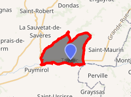
Tayrac, Lot-et-Garonne
Tayrac is a commune in the Lot-et-Garonne department in south-western France.
Tayrac | |
|---|---|
The town hall in Tayrac | |
.svg.png) Coat of arms | |
Location of Tayrac 
| |
 Tayrac  Tayrac | |
| Coordinates: 44°11′53″N 0°50′33″E | |
| Country | France |
| Region | Nouvelle-Aquitaine |
| Department | Lot-et-Garonne |
| Arrondissement | Agen |
| Canton | Le Pays de Serres |
| Intercommunality | Porte d'Aquitaine en Pays de Serres |
| Government | |
| • Mayor (2004–2008) | Gilbert Tovo |
| Area 1 | 12.89 km2 (4.98 sq mi) |
| Population (2017-01-01)[1] | 397 |
| • Density | 31/km2 (80/sq mi) |
| Time zone | UTC+01:00 (CET) |
| • Summer (DST) | UTC+02:00 (CEST) |
| INSEE/Postal code | 47305 /47270 |
| Elevation | 62–193 m (203–633 ft) (avg. 195 m or 640 ft) |
| 1 French Land Register data, which excludes lakes, ponds, glaciers > 1 km2 (0.386 sq mi or 247 acres) and river estuaries. | |
Geography
The Séoune forms the commune's southern border.
gollark: I mean, so far, I'm trying to avoid cloud stuff by running most of my services locally, but I have to interact with cloudy stuff to actually communicate with people, and regardless of what I do there'll be all kinds of shadowy data mining going on.
gollark: I kind of hope the cloud thing will begin to recede as P2P technology improves and computers get fast enough that you can run a decent amount on a £50 RPi kit, but sadly... it probably won't.
gollark: Anyway, I'll add your thoughts to the blog post there.
gollark: Yes, I guessed as much.
gollark: No.
References
- "Populations légales 2017". INSEE. Retrieved 6 January 2020.
| Wikimedia Commons has media related to Tayrac (Lot-et-Garonne). |
This article is issued from Wikipedia. The text is licensed under Creative Commons - Attribution - Sharealike. Additional terms may apply for the media files.