Tavarnelle Val di Pesa
Tavarnelle Val di Pesa is a comune (municipality) in the Metropolitan City of Florence in the Italian region Tuscany, located about 25 kilometres (16 miles) south of Florence.
Tavarnelle Val di Pesa | |
|---|---|
| Comune di Tavarnelle Val di Pesa | |
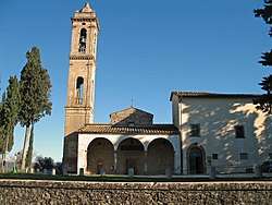
 Pieve of San Pietro in Bossolo. | |
 Coat of arms | |
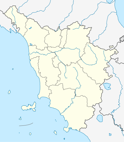
Location of Tavarnelle Val di Pesa 
| |
 Tavarnelle Val di Pesa Location of Tavarnelle Val di Pesa in Italy  Tavarnelle Val di Pesa Tavarnelle Val di Pesa (Tuscany) | |
| Coordinates: 43°33′N 11°10′E | |
| Country | Italy |
| Region | Tuscany |
| Metropolitan city | Florence (FI) |
| Frazioni | Badia a Passignano, Sambuca Val di Pesa, San Donato in Poggio |
| Government | |
| • Mayor | Sestilio Dirindelli (Democratic Party) |
| Area | |
| • Total | 57.0 km2 (22.0 sq mi) |
| Elevation | 378 m (1,240 ft) |
| Population (1 January 2007)[2] | |
| • Total | 7,346 |
| • Density | 130/km2 (330/sq mi) |
| Demonym(s) | Tavarnellini: Frazioni: Sambuchini, Sandonatini |
| Time zone | UTC+1 (CET) |
| • Summer (DST) | UTC+2 (CEST) |
| Postal code | 50028 |
| Dialing code | 055 |
| Patron saint | St. Lucy |
| Saint day | December 13 |
| Website | Official website |
Main sights
The main attraction of the territory of Tavarnelle is the Badia di Passignano (Abbey of Passignano), a monastery existing from the High Middle Ages.[3]
Other sights include:
- Church of Santa Lucia al Borghetto, part of a Franciscan monastery known from 1260. The church is an example of Gothic architecture.
- Gothic church of Madonna della Neve, with 14th-15th-century frescoes.
- Church of Santa Maria del Carmine al Morrocco (15th century)
- Sanctuary of Santa Maria delle Grazie a Pietracupa, founded in 1596, with a Madonna image frescoed by Paolo Schiavo.
- Pieve of San Pietro in Bossolo, a Romanesque church known from 990, housing works from Roman, Byzantine and Florentine schools.
- Villa di Spoiano, renaissance villa between Tavarnelle Val di Pesa and Barberino Val d'Elsa
- Villa di Poggio Petroio, outside the town.
- The pieve of San Donato in Poggio (12th century), in Romanesque style, with a basilica plan with a nave and two aisles and three apses. It houses a baptism shell by Giovanni della Robbia (1513) and a triptych by Giovanni del Biondo (1375).
- Bridge over the Pesa River in the frazione of Sambuca.
Tignano is a fortified hamlet whose church of San Romolo houses a terracotta tabernacle by Giovanni della Robbia.
gollark: Just nothing.
gollark: No...
gollark: `[this space intentionally left blank]`
gollark: Not having $s?
gollark: That sounds awfully PHPish.
References
- "Superficie di Comuni Province e Regioni italiane al 9 ottobre 2011". Istat. Retrieved 16 March 2019.
- All demographics and other statistics: Italian statistical institute Istat.
- Hornik, Heidi J. (2009). Michele Tosini and the Ghirlandaio Workshop in Cinquecento Florence. Sussex Academic Press. p. 56. ISBN 978-1-84519-186-3.
This article is issued from Wikipedia. The text is licensed under Creative Commons - Attribution - Sharealike. Additional terms may apply for the media files.
