Tarma District
Tarma District is one of nine districts of the province Tarma in Peru.[1]
Tarma | |
|---|---|
Tarma | |
| Country | |
| Region | Junín |
| Province | Tarma |
| Capital | Tarma |
| Government | |
| • Mayor | Moisés Tacuri |
| Area | |
| • Total | 459.95 km2 (177.59 sq mi) |
| Elevation | 3,053 m (10,016 ft) |
| Population (2017) | |
| • Total | 47,775 |
| • Density | 100/km2 (270/sq mi) |
| Time zone | UTC-5 (PET) |
| UBIGEO | 120701 |
| Website | munitarma.gob.pe |
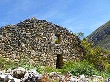
The archaeological site Tarmatampu is situated in the district.
Geography
Some of the highest mountains of the district are listed below:[2]
- Antamarka
- Hirkan Kancha
- Kunkan
- Kuntur Sinqa
- Kuntur Wayin
- Misapata
- Pirwa Pirwa
- P'unchawmarka
- Sarawisa
- Uchku Mach'ay
- Ukru Kancha
- Wank'a Wank'a
- Warmi Sinqa
- Yuraq Kancha
- Yuraq Marka
Images
 Tarmatampu
gollark: I SAID RULE FOUR.
gollark: Preemptive R4 invocation.
gollark: ...
gollark: Yes.
gollark: I mean, they still produce bee milk.
References
- (in Spanish) Instituto Nacional de Estadística e Informática. Banco de Información Distrital Archived 2008-04-23 at the Wayback Machine. Retrieved April 11, 2008.
- escale.minedu.gob.pe - UGEL map of the Tarma Province (Junín Region)
This article is issued from Wikipedia. The text is licensed under Creative Commons - Attribution - Sharealike. Additional terms may apply for the media files.