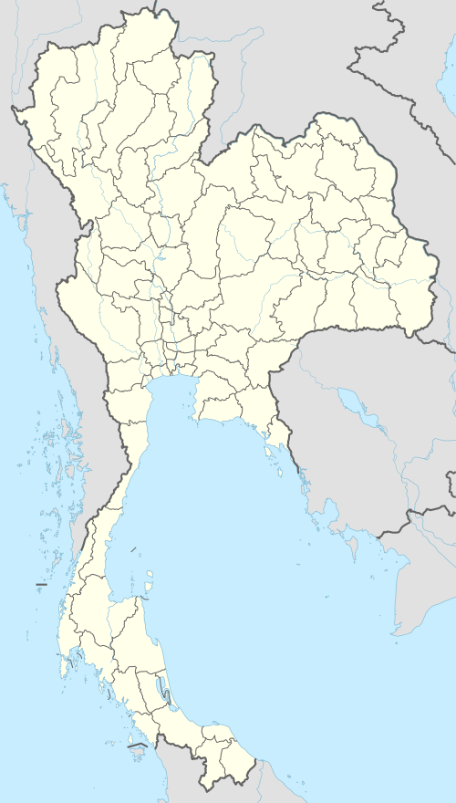
Tak, Thailand
Tak (Thai: ตาก, pronounced [tàːk]) is a town (thesaban mueang) in north-west Thailand, capital of the Tak Province and the Tak district. As of 2005 the town had a population of 19,900 and an area of 7.27 km². It covers the tambon Rahaeng, Nong Luang, Chiang Ngoen, and Hua Diat. It is on the Ping River, 418 km north-north-west of Bangkok.
Tak ตาก | |
|---|---|
Town | |
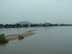 Ping River, Tak | |
 Tak | |
| Coordinates: 16°52′16″N 99°07′30″E | |
| Country | |
| Province | Tak |
| Amphoe | Mueang Tak |
| Area | |
| • Total | 7.27 km2 (2.81 sq mi) |
| Population (2017) | |
| • Total | 20,290 |
| • Density | 2,790.9/km2 (7,228/sq mi) |
| Time zone | UTC+7 (ICT) |
Geography
Tak is on the Ping River, which runs from north to south through the town. While the land to the east is fairly flat, the Tenasserim Hills and Dawna Range lie to the west.
Climate
Tak has a tropical savanna climate (Köppen climate classification Aw). Winters are dry and very warm. Temperatures rise until April, which is very hot with the average daily maximum at 38.5 °C (101.3 °F). The monsoon season runs from May through October, with heavy rain and somewhat cooler temperatures during the day, although nights remain warm.
| Climate data for Tak (1981–2010) | |||||||||||||
|---|---|---|---|---|---|---|---|---|---|---|---|---|---|
| Month | Jan | Feb | Mar | Apr | May | Jun | Jul | Aug | Sep | Oct | Nov | Dec | Year |
| Record high °C (°F) | 38.0 (100.4) |
41.2 (106.2) |
42.7 (108.9) |
44.0 (111.2) |
42.8 (109.0) |
40.3 (104.5) |
37.9 (100.2) |
38.0 (100.4) |
37.1 (98.8) |
36.3 (97.3) |
37.6 (99.7) |
36.6 (97.9) |
44.0 (111.2) |
| Average high °C (°F) | 32.4 (90.3) |
35.3 (95.5) |
37.6 (99.7) |
38.5 (101.3) |
35.2 (95.4) |
33.0 (91.4) |
32.5 (90.5) |
32.3 (90.1) |
32.6 (90.7) |
31.7 (89.1) |
31.1 (88.0) |
30.5 (86.9) |
33.6 (92.5) |
| Daily mean °C (°F) | 24.1 (75.4) |
27.3 (81.1) |
30.2 (86.4) |
31.5 (88.7) |
29.6 (85.3) |
28.4 (83.1) |
28.1 (82.6) |
27.9 (82.2) |
27.7 (81.9) |
26.8 (80.2) |
25.2 (77.4) |
23.0 (73.4) |
27.5 (81.5) |
| Average low °C (°F) | 17.0 (62.6) |
19.8 (67.6) |
23.9 (75.0) |
26.2 (79.2) |
25.6 (78.1) |
25.3 (77.5) |
25.1 (77.2) |
24.8 (76.6) |
24.2 (75.6) |
23.0 (73.4) |
20.5 (68.9) |
17.0 (62.6) |
22.7 (72.9) |
| Record low °C (°F) | 7.5 (45.5) |
10.7 (51.3) |
11.0 (51.8) |
19.2 (66.6) |
20.5 (68.9) |
21.7 (71.1) |
20.5 (68.9) |
20.2 (68.4) |
19.5 (67.1) |
15.1 (59.2) |
9.3 (48.7) |
6.0 (42.8) |
6.0 (42.8) |
| Average rainfall mm (inches) | 2.1 (0.08) |
8.7 (0.34) |
12.1 (0.48) |
57.6 (2.27) |
174.9 (6.89) |
127.8 (5.03) |
87.7 (3.45) |
115.8 (4.56) |
215.5 (8.48) |
199.2 (7.84) |
54.6 (2.15) |
5.1 (0.20) |
1,061.1 (41.78) |
| Average rainy days | 0.5 | 0.8 | 1.9 | 5.1 | 12.8 | 15.4 | 14.3 | 15.3 | 16.2 | 13.9 | 4.8 | 1.0 | 102.0 |
| Average relative humidity (%) | 65 | 54 | 49 | 54 | 69 | 74 | 73 | 74 | 78 | 82 | 78 | 72 | 69 |
| Mean monthly sunshine hours | 275.9 | 259.9 | 275.9 | 243.0 | 217.0 | 117.0 | 120.9 | 117.8 | 108.0 | 179.8 | 219.0 | 257.3 | 2,391.5 |
| Mean daily sunshine hours | 8.9 | 9.2 | 8.9 | 8.1 | 7.0 | 3.9 | 3.9 | 3.8 | 3.6 | 5.8 | 7.3 | 8.3 | 6.6 |
| Source 1: Thai Meteorological Department[1] | |||||||||||||
| Source 2: Office of Water Management and Hydrology, Royal Irrigation Department (sun and humidity)[2] | |||||||||||||
Transportation
Route 105, through Mae Sot, forms one of two major transnational roads through the Tenasserim Hills to Burma. Route 1, also known as the Phahonyothin Road, passes through Tak. On the north side it leads to Lampang, Chiang Rai, and the border with Burma at Mae Sai. On the south side it leads to Kamphaeng Phet, Nakhon Sawan, and Bangkok. Route 12 leads east to Sukhothai, Phitsanulok, Chum Phae, Khon Kaen, Kalasin, and the border with Laos at Mukdahan.
Tak is served by Tak Airport, 13 kilometres (8.1 mi) east of the town.[3]
References
- "Climatological Data for the Period 1981–2010". Thai Meteorological Department. p. 5. Retrieved 31 July 2016.
- "ปริมาณการใช้น้ำของพืชอ้างอิงโดยวิธีของ Penman Monteith (Reference Crop Evapotranspiration by Penman Monteith)" (PDF) (in Thai). Office of Water Management and Hydrology, Royal Irrigation Department. p. 27. Retrieved 31 July 2016.
- "Tak Airport". OurAirports. Retrieved 3 February 2013.
External links
| Wikimedia Commons has media related to Tak (town). |

- Website of town (Thai)