Tărlung
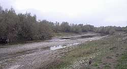
The Tărlung (in its upper course also: Ramura Mare) is a left tributary of the river Râul Negru in Romania.[1][2] It discharges into the Râul Negru in Băcel. Its length is 57 km (35 mi) and its basin size is 485 km2 (187 sq mi).[2]
| Tărlung | |
|---|---|
 | |
| Location | |
| Country | Romania |
| Counties | Brașov, Covasna |
| Villages | Tărlungeni, Budila |
| Physical characteristics | |
| Source | Ciucaș Mountains |
| Mouth | Râul Negru |
• location | Băcel |
• coordinates | 45.7611°N 25.8296°E |
| Length | 57 km (35 mi) |
| Basin size | 485 km2 (187 sq mi) |
| Basin features | |
| Progression | Râul Negru→ Olt→ Danube→ Black Sea |
Tributaries
The following rivers are tributaries to the river Tărlung (from source to mouth):[2]
- Left: Urlățel, Urlatul Mic, Doftana, Gârcin
- Right: Capra Mică, Valea Cailor, Ramura Mică, Tesla, Dracu, Valea Satului, Zizin, Seaca, Valea Popii, Teliu, Dobârlău
gollark: ...
gollark: It turns out I actually just needed to run the "share" command to get them to see each other.
gollark: Enjoy.
gollark: https://kit.osmarks.net/ is up.
gollark: Okay, forwarding.
References
- "Planul național de management. Sinteza planurilor de management la nivel de bazine/spații hidrografice, anexa 7.1" (PDF, 5.1 MB). Administrația Națională Apele Române. 2010. pp. 657–658.
- Atlasul cadastrului apelor din România. Partea 1 (in Romanian). Bucharest: Ministerul Mediului. 1992. pp. 271–272. OCLC 895459847. River code: VIII.1.45.22
This article is issued from Wikipedia. The text is licensed under Creative Commons - Attribution - Sharealike. Additional terms may apply for the media files.