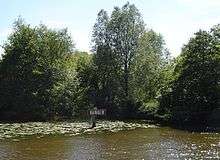
Swift Ditch
The Swift Ditch is a backwater of the River Thames in England, which was formerly the primary navigation channel. With the main river, it creates the large island of Andersey Island near Abingdon, Oxfordshire.
As early as 955 to 963 AD, the monks of Abingdon Priory built a canal to the Abbey from the direction of Swift Ditch. There is also evidence that the current course of the river to the confluence had been built by 1060.[1]
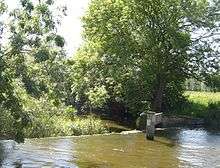
During Tudor times, the backwater was known as Purden's Stream. However by the ned of the Tudor period it was known as Swift Ditch, remaining the faster route.[2] The Oxford-Burcot Commission of 1605 and 1624 sought to develop Swift Ditch as the main route for boats. A pound lock was built at its head in about 1636.[2]
In 1788 several citizens of Abingdon wanted to divert navigation back to the current course and as a result Abingdon Lock was built near the town. Within ten years, the Wilts & Berks Canal connected to the current navigation channel at Abingdon.[1]
Culham Bridges
The Swift Ditch is crossed by three bridges at its southern end. The original Culham Bridge was built about the same time as the Abingdon Bridges across the site of a ford. It has been replaced by a more modern bridge carrying the A415 road beside it. A wooden footbridge further downstream carries the Thames Path.
References
- Fred. S. Thacker The Thames Highway: Volume II Locks and Weirs 1920 - republished 1968 David & Charles
- Victoria County History - A History of the County of Oxford Volume 7, pages 27-39 (Culham). Retrieved 21 July 2020.