Svelten Peak
Svelten Peak is a sharp peak rising to 300 m on Hurd Peninsula, Livingston Island in the South Shetland Islands, Antarctica and surmounting False Bay to the southeast. It is the summit of the 600 m long, narrow and rocky Querchan Ridge descending southeastwards to the seashore.
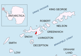
Location of Hurd Peninsula on Livingston Island in the South Shetland Islands.

Svelten Peak (second left) from Mount Friesland.
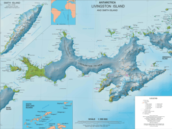
Topographic map of Livingston Island featuring the peak.
The peak is named by personnel of the nearby Spanish base Juan Carlos Primero and appears in the 2009 Bulgarian map of Livingston Island.[1]
Location
The peak is located at 62°41′30″S 60°21′20″W which is 430 m southeast of Pirámide Peak, 670 m west-southwest of Moores Peak, 4.01 km north-northwest of Canetti Peak, 2.17 km east-northeast of MacGregor Peaks and 1.57 km east of Castellvi Peak (Spanish mapping in 1991 and Bulgarian in 2009).
Map
- Isla Livingston: Península Hurd. Mapa topográfico de escala 1:25000. Madrid: Servicio Geográfico del Ejército, 1991. (Map reproduced on p. 16 of the linked work)
- Antarctic Digital Database (ADD). Scale 1:250000 topographic map of Antarctica. Scientific Committee on Antarctic Research (SCAR). Since 1993, regularly upgraded and updated.
- L.L. Ivanov. Antarctica: Livingston Island and Smith Island. Scale 1:100000 topographic map. Manfred Wörner Foundation, 2017. ISBN 978-619-90008-3-0
Notes
- L.L. Ivanov. Antarctica: Livingston Island and Greenwich, Robert, Snow and Smith Islands. Scale 1:120000 topographic map. Troyan: Manfred Wörner Foundation, 2009. ISBN 978-954-92032-6-4
gollark: This is... immensely troubling.
gollark: The AUR package broke.
gollark: Hold on while I cloninate CraftOS-PC and try and figure out how to compile it.
gollark: I dislike your use of Golang.
gollark: Wow, you have at least three projects.
This article is issued from Wikipedia. The text is licensed under Creative Commons - Attribution - Sharealike. Additional terms may apply for the media files.