Sussex Border Path
The Sussex Border Path is a long-distance footpath around the borders of Sussex, a historic county and former medieval kingdom in southern England. The main path is 222 km (138 mi) long and stays close to Sussex's borders with Hampshire, Surrey and Kent, connecting Thorney Island[1] to Rye.[2] There is also an additional 53 km (33 mi) spur known as the Mid Sussex Path which links East Grinstead with Fishersgate and Mile Oak on the western boundary of the city of Brighton and Hove.
| Sussex Border Path | |
|---|---|
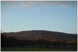 Blackdown is the highest point on the Sussex Border Path and in Sussex, January 2009 | |
| Length | 273 km (170 mi) |
| Location | South Eastern England, United Kingdom |
| Designation | Long-distance footpath |
| Trailheads | Thorney Island, West Sussex 50.821°N 0.921°W Rye, East Sussex 50.949°N 0.729°E |
| Use | Hiking |
| Elevation | |
| Elevation change | 3,130 m (10,270 ft) |
| Highest point | Blackdown, 280 m (920 ft) |
| Hiking details | |
| Trail difficulty | Easy |
| Season | All year |
| Waymark | |
The Sussex Border Path is not a National Trail although in 2020 it is expected that the England Coast Path National Trail will be completed, which will include a trail around the coast of Sussex. Together the two paths will make a route allowing for a complete walk around Sussex.
History
The path was first devised and published in 1983 by Ben Perkins and Aeneas Macintosh.[3] The footpath uses existing rights of way to follow the Sussex county border and is waymarked. It is managed by volunteer teams from the Sussex area of the Ramblers. The path is waymarked with signs showing a martlet, the heraldic bird found on the Sussex flag and heraldic shield.
Sussex's external boundaries probably crystallised around the 6th and 7th centuries.[4] To the west, Bede describes the boundary with the Kingdom of Wessex as being opposite the Isle of Wight,[5] and which later fell on the River Ems. To the east at Romney Marsh and the River Limen (now called the River Rother or Kent Ditch), Sussex shared a border with the Kingdom of Kent. North of the Forest Ridge in the Wealden forest lay the sub-kingdom of Surrey, which became a frontier area disputed by various kingdoms until it later became part of Wessex.
In 1974 the area of Sussex was divided into two ceremonial counties, East and West Sussex, and Sussex continues to formally exist as a historic county.[6][7] The Mid Sussex link follows the boundary between the current ceremonial counties of East and West Sussex.
Route
The Sussex Border Path begins at Thorney Island, now effectively a peninsular that juts into Chichester Harbour. The path encircles the island and then extends across the South Coast Plain to Emsworth on the Hampshire side of the River Ems, the river which forms the Sussex-Hampshire border at this location. The path continues over the chalk ridge of the South Downs and onto the Greensand Ridge of the western Weald. Here the trail ascends Blackdown, the highest point in Sussex at 280 metres (920 ft) and the highest point on the Sussex Border Path.
From Blackdown the path continues into the Low Weald to Gatwick Airport and into the High Weald to the town of East Grinstead. From here the path descends to the Romney marshes to end in the historic town of Rye.
The Mid Sussex Link begins at East Grinstead and passes through Sharpthorne and Scaynes Hill to Ditchling, then over the South Downs to Fishersgate, between Southwick and Portslade.
Image gallery
- Great Deep separates Thorney Island from the mainland
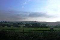
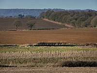 Farmland near Rogate
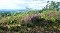 Near Blackdown
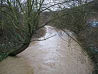 The Gatwick Stream near Gatwick Airport
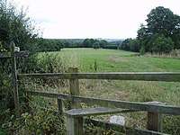 Near Crawley Down
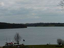
.jpg)
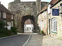 The town of Rye marks the eastern terminus of the Sussex Border Path
 A section of the Mid Sussex Link shared with the Forest Way, following a former railway line between East Grinstead and Groombridge
See also
- South Downs Way
- The Four Men: a Farrago
References
- 50.821°N 0.921°W
- 50.949°N 0.729°E
- "Sussex Border Path". Sussex Ramblers. Retrieved 27 September 2019.
- Thomas, Gabor (January 2013). "Resource Assessment and Research Agenda for the Anglo-Saxon period" (PDF) (PDF). South East Research Framework.
- Kirby 2000, p. 5
- "Eric Pickles: celebrate St George and England's traditional counties". Department for Communities and Local Government. 23 April 2013. Retrieved 22 June 2013.
- Kelner, Simon (23 April 2013). "Eric Pickles's championing of traditional English counties is something we can all get behind". The Independent. London. Retrieved 22 June 2013.
External links
- The Sussex Border Path Long Distance Walking Route
- The Sussex Border Path, Long Distance Walkers Association
