Sumdorong Chu
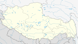
Sumdorong Chu, referred to as Sangduoluo He (Chinese: 桑多洛河) in the Chinese media,[1] is a tributary of the Nyamjang Chu river that flows along the disputed Sino-Indian border between the Cona County of Tibet and the Tawang district of Arunachal Pradesh. It orignates in the Tokpo Shiri Glacier on top of the eastern watershed range of Nyamjang Chu, and flows down to join Nyamjang Chu after over a distance of 7–10 kilometres.[2] Its junction with Nyamjang Chu is to the north of that of Namka Chu, another contested river valley, by about two kilometers.
| Sumdorong Chu | |
|---|---|
 Mouth of Sumdorong Chu in Nyamjang Chu 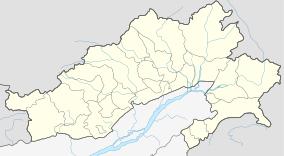 Sumdorong Chu (Arunachal Pradesh) | |
| Location | |
| Country | China; India |
| Region | Shannan, Tibet; Arunachal Pradesh |
| District | Cona County; Tawang district |
| City | Lai Menba Minzu Township; Zemithang Circle |
| Physical characteristics | |
| Source | Eastern Himalayas |
| • location | Lai Menba Minzu Township |
| • coordinates | 27°47′44″N 91°49′18″E |
| • elevation | 4,600 m (15,100 ft) |
| Mouth | Nyamjang Chu valley |
• coordinates | 27°48′00″N 91°44′42″E |
• elevation | 2,350 m (7,710 ft) |
| Basin features | |
| Progression | Nyamjang Chu, Tawang Chu, Manas River |
| River system | Brahmaputra |
The Sumdorong Chu valley was the site of another standoff between India and China in 1986–1987 which, despite giving rise to the fears of another war, was successfully deescalated. Subsequently, India and China formulated agreements for managing future border tensions.[3][4]
Location
Sumdorong Chu flows in a disputed border region between Tibet's Cona County and Arunachal Pradesh's Tawang district. The dispute arises due to differing interpreations of where the McMahon Line lies.
China adheres to the 1914 map of the McMahon Line, which shows the border as a straight line at 27°44'30" N latitude till the range of "Menlakathong La" (roughly the modern Bum La Pass).[5] India believes that the true border lay along the highest watershed line in the region, which runs along the northern watersheds of Namka Chu and Sumdorong Chu streams.[6]
1987 standoff
See also
References
- "India-China Border Dispute". GlobalSecurity.org. Retrieved 1 August 2017.
- "Chinese troops in Kameng", The Hindustan Times, 17 July 1986, in China and South Asia (1987).
- V. Natarajan (12 October 2006). "The Sumdorong Chu Incident". Bharat Rakshak. Retrieved 1 August 2017.
- Pardesi, Managing the Sumdorong Chu Crisis (2020).
- A. G. Noorani, Perseverance in peace process, Frontline, 29 August 2003.
- Bhuvan, Indian Geo-Platform of ISRO, search key: "Kenze Mane,ARUNACHAL PRADESH", retrieved 13 July 2020.
Bibliography
- "China and South Asia (July-September 1986)". China Report. 23 (1): 113–139. February 1987. doi:10.1177/000944558702300111. ISSN 0009-4455.
- Fravel, M. Taylor (2008), Strong Borders, Secure Nation: Cooperation and Conflict in China's Territorial Disputes, Princeton University Press, ISBN 1-4008-2887-2
- Hoffmann, Steven A. (2018) [first published 1990], India and the China Crisis, University of California Press, ISBN 978-0-520-06537-6
- Pardesi, Manjeet S. (2020). "Managing the 1986-87 Sino-Indian Sumdorong Chu Crisis". India Review. 18 (5): 534–551. doi:10.1080/14736489.2019.1703364. ISSN 1473-6489.