Suiattle River
The Suiattle River is a river in the U.S. state of Washington.
| Suiattle River | |
|---|---|
.jpg) Suiattle River Crossing | |
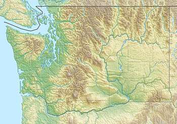
 Location of the mouth of the Suiattle River in Washington  Suiattle River (the United States) | |
| Location | |
| Country | United States |
| State | Washington |
| Counties | Skagit, Snohomish |
| Physical characteristics | |
| Source | Suiattle Glacier |
| • coordinates | 48°4′56″N 121°5′28″W[1] |
| • elevation | 6,077 ft (1,852 m)[2] |
| Mouth | Sauk River |
• coordinates | 48°20′17″N 121°32′55″W[1] |
• elevation | 377 ft (115 m)[3] |
| Length | 45 mi (72 km)[4] |
| Discharge | |
| • location | USGS gage 12129000, near Manford, WA[5] |
| • average | 1,750 cu ft/s (50 m3/s)[5] |
| • minimum | 430 cu ft/s (12 m3/s) |
| • maximum | 30,700 cu ft/s (870 m3/s) |
Course
The Suiattle River originates from the Suiattle Glacier on the east slopes of Glacier Peak in the Cascade Range. It flows generally northwest to join the Sauk River north of Darrington. The Sauk River in turn joins the Skagit River, which empties into Skagit Bay, part of Puget Sound.[6] It is a National Wild and Scenic River.[7]
Tributaries
The Suiattle's largest tributaries include Chocolate Creek, entering the river's upper reaches, Dusty Creek, Sulpher Creek and Downey Creek. Image Lake is in the river's drainage basin.[8]
gollark: This is the test track.
gollark: It can automatically dispense carts and do routing using a lot of computer-switched T-junctions.
gollark: I have made a mostly fully automated multi-endpoint rail transport system in Minecraft.
gollark: Oh, Grafana anomalously stopped working, fun.
gollark: Great! 2ms seems weirdly high, but whatever.
See also
- List of rivers of Washington
References
- U.S. Geological Survey Geographic Names Information System: Suiattle River
- Source elevation derived from Google Earth search using GNIS source coordinates.
- Mouth elevation derived from Google Earth search using GNIS source coordinates.
- Length calculated in Google Earth using the path tool.
- "Historical data, water years 1938-1949, for USGS gage 12129000, Suiattle River near Mansford, WA". USGS. Retrieved 3 August 2009.
- "Washington Water Year 2005" (pdf). United States Geological Survey (USGS). 2005. Retrieved September 3, 2008.
- "Skagit Wild and Scenic River, Washington". The Wild & Scenic Rivers Council. Archived from the original on 15 October 2011. Retrieved 22 October 2011.
- Spring, Ira; Manning, Harvey (1998). 100 Classic Hikes in Washington — Ira Spring, Harvey Manning — Google Books. 100 Classic Hikes in Washington (published July 31, 1998). pp. 94–95. ISBN 978-1-59485-384-5. Retrieved July 27, 2013.
This article is issued from Wikipedia. The text is licensed under Creative Commons - Attribution - Sharealike. Additional terms may apply for the media files.