Stránecká Zhoř
Stránecká Zhoř is a village and municipality (obec) in Žďár nad Sázavou District in the Vysočina Region of the Czech Republic.
Stránecká Zhoř | |
|---|---|
Municipality | |
 | |
 Flag  Coat of arms | |
 Stránecká Zhoř | |
| Coordinates: 49°22′50″N 15°55′41″E | |
| Country | |
| Region | Vysočina |
| District | Žďár nad Sázavou |
| Area | |
| • Total | 11.91 km2 (4.60 sq mi) |
| Elevation | 497 m (1,631 ft) |
| Population (1.1.2014) | |
| • Total | 608 |
| • Density | 51/km2 (130/sq mi) |
| Postal code | 594 01 to 594 42 |
| Website | http://www.straneckazhor.cz |
The municipality covers an area of 11.91 square kilometres (4.60 sq mi), and has a population of 582 (as at 3 July 2006).
Stránecká Zhoř lies approximately 21 kilometres (13 mi) south of Žďár nad Sázavou, 25 km (16 mi) east of Jihlava, and 134 km (83 mi) south-east of Prague.
Gallery
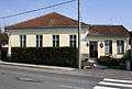 Municipal office
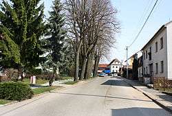
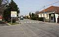 Road No 602
gollark: Yes.
gollark: The biter swarms mostly only went after radar (peaceful mode) and artillery, so biters would frequently just ablate all the radar on some of the rail lines to faraway sites while going after artillery stations.
gollark: Well, the spiderbots were more for nearby nests, artillery stuff had laser turrets.
gollark: There were frequently biter incursions (peaceful mode, but we deployed MUCH artillery) so I frequently had to send in spiderbots to pacify them.
gollark: It's not, because the bots take ages to go anywhere.
This article is issued from Wikipedia. The text is licensed under Creative Commons - Attribution - Sharealike. Additional terms may apply for the media files.