Stitswerd
Stitswerd is a village in the municipality of Het Hogeland, Groningen, the Netherlands. It had a population of around 45 in January 2017.[1] Stitswerd is located on a wierde near the estuary of the former river Fivel.
Stitswerd | |
|---|---|
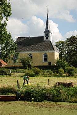 The church of Stitswerd | |
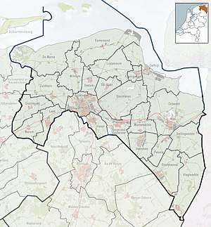 Stitswerd Location of Stitswerd in the province of Groningen | |
| Coordinates: 53°21′40″N 6°35′57″E | |
| Country | Netherlands |
| Province | Groningen |
| Municipality | Het Hogeland |
| Area | |
| • Total | 0.18 km2 (0.07 sq mi) |
| Population (2017) | |
| • Total | 65 |
| • Density | 360/km2 (940/sq mi) |
| Time zone | UTC+1 (CET) |
| • Summer (DST) | UTC+2 (CEST) |
| Postal code | 9999 |
| Dialing code | 0595 |
Stitswerd has the highest postal code in the Netherlands (9999 XL).
History
It was part of Kantens municipality before 1990, when it became part of Hefshuizen.
gollark: What benefit does introducing oopy indirection bring?
gollark: WHY??!?!?!?
gollark: is an esoteric programming language.
gollark: WHY?
gollark: `this`, I mean, not "this" the demonstrative pronoun.
References
- Kerncijfers wijken en buurten 2017 - CSB Statline
External links

This article is issued from Wikipedia. The text is licensed under Creative Commons - Attribution - Sharealike. Additional terms may apply for the media files.