Stert
Stert is a village and civil parish in Wiltshire, England. Its nearest town is Devizes, about 2 miles (3.2 km) away to the northwest.
| Stert | |
|---|---|
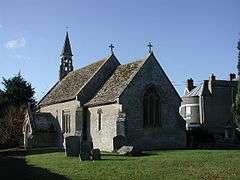
 Church of St James | |
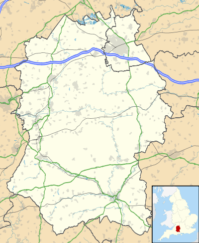
 Stert Location within Wiltshire | |
| Population | 176 (in 2011)[1] |
| OS grid reference | SU032593 |
| Unitary authority | |
| Ceremonial county | |
| Region | |
| Country | England |
| Sovereign state | United Kingdom |
| Post town | Devizes |
| Postcode district | SN10 |
| Dialling code | 01380 |
| Police | Wiltshire |
| Fire | Dorset and Wiltshire |
| Ambulance | South Western |
| UK Parliament | |
| Website | Parish |
The village is south of the A342 Devizes-Andover road. The Wayside Monument (previously known as The Long Monument) stands at the roadside, just over the border in Etchilhampton parish. It was erected in 1771 and dedicated to James Long of Wedhampton, who had promoted the diversion of the road to a more southerly route, avoiding Etchilhampton Hill.[2][3]
History
Stert was recorded as having 22 households in the 1086 Domesday Book.[4] In 1393 William of Wykeham, Bishop of Winchester, conveyed the manor to New College, Oxford who retained ownership until the middle of the 20th century.[3]
The Manor Farmhouse, next to the church, is from the 17th century and late 18th.[5]
A school was built in the village in 1842 and attended by children of all ages. The school closed in 1927 after a decline in the local population.[6]
Religious sites
A chapel at Stert is first mentioned c. 1232 and it has always been a chapelry of Urchfont parish. The church of St James stands on the highest ground in the parish.[7] In 1846, to increase its capacity it was largely rebuilt by J.H. Hakewill, retaining the Perpendicular north aisle.[8]
A Methodist chapel was built in the village c. 1869 and sold to the Devizes Baptists in 1887.[9] The chapel closed in 1957 and passed into residential use.[10]
Railways
The Berks and Hants Extension Railway was built through the parish, passing close to the north of Stert village, for the GWR in 1862. This provided a route from Hungerford via Pewsey to Devizes, where trains continued westward on the 1857 line. In 1900 the GWR built the Stert and Westbury Railway, which diverged from the earlier line near Patney, east of Stert parish, and later formed part of the parish's southern boundary. This line avoided the hill at Devizes to make a direct route to Westbury and southwest England; in 1906 it became part of the Reading to Taunton Line.
The line through Devizes closed in 1966 and was dismantled, while the 1900 line is still in use.
References
- "Wiltshire Community History - Census". Wiltshire Council. Retrieved 30 January 2016.
- Historic England. "Wayside monument (1286071)". National Heritage List for England. Retrieved 30 January 2016.
- "Victoria County History - Wiltshire - Vol 10 pp 155-159 - Parishes: Stert". British History Online. University of London. Retrieved 30 January 2016.
- Stert in the Domesday Book
- Historic England. "Manor Farmhouse (1364705)". National Heritage List for England. Retrieved 30 January 2016.
- "National School, Stert". Wiltshire Community History. Wiltshire Council. Retrieved 30 January 2016.
- "Church of St. James, Stert". Wiltshire Community History. Wiltshire Council. Retrieved 30 January 2016.
- Historic England. "Church of St James (1035669)". National Heritage List for England. Retrieved 30 January 2016.
- "Methodist Chapel, Stert". Wiltshire Community History. Wiltshire Council. Retrieved 30 January 2016.
- "Baptist Chapel, Stert". Wiltshire Community History. Wiltshire Council. Retrieved 30 January 2016.
External links
- "Stert". Wiltshire Community History. Wiltshire Council. Retrieved 30 January 2016.
- Stert Parish
- Stert at genuki.org.uk
![]()