Staunton, Ohio
Staunton is an unincorporated community in Fayette County, in the U.S. state of Ohio.[1]
History
Staunton was platted in 1848.[2] The community was named after Staunton, Virginia, the native home of a share of the first settlers.[3] A post office was established at Staunton in 1844, and remained in operation until 1903.[4]
gollark: Monopsony™ can support remote terminals over ender chests.
gollark: Didn't you read the GTech™ procedures manual?
gollark: I'll initiate Contingency Tau-105.4/H.
gollark: I see.
gollark: Knijn, do you really think GTech™ doesn't know what's happening at all your sites constantly?
References
- U.S. Geological Survey Geographic Names Information System: Staunton, Ohio
- Allen, Frank M. (1914). History of Fayette County, Ohio: Her People, Industries and Institutions. B. F. Bowen, Incorporated. p. 303.
- Overman, William Daniel (1958). Ohio Town Names. Akron, OH: Atlantic Press. p. 129.
- "Fayette County". Jim Forte Postal History. Retrieved 13 December 2015.
Municipalities and communities of Fayette County, Ohio, United States | ||
|---|---|---|
| City | 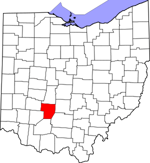 Map of Ohio highlighting Fayette County | |
| Villages | ||
| Townships | ||
| CDPs | ||
| Unincorporated communities |
| |
| Footnotes | ‡This populated place also has portions in an adjacent county or counties | |
This article is issued from Wikipedia. The text is licensed under Creative Commons - Attribution - Sharealike. Additional terms may apply for the media files.