Starr Township, Cloud County, Kansas
Starr Township is a township in Cloud County, Kansas, USA. As of the 2000 census, its population was 653.
Starr Township | |
|---|---|
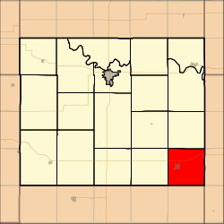 Location in Cloud County | |
| Coordinates: 39°21′30″N 097°25′31″W | |
| Country | United States |
| State | Kansas |
| County | Cloud |
| Area | |
| • Total | 35.62 sq mi (92.24 km2) |
| • Land | 35.54 sq mi (92.05 km2) |
| • Water | 0.07 sq mi (0.19 km2) 0.21% |
| Elevation | 1,424 ft (434 m) |
| Population (2000) | |
| • Total | 653 |
| • Density | 18.4/sq mi (7.1/km2) |
| GNIS feature ID | 0476009 |
Geography
Starr Township covers an area of 35.62 square miles (92.3 km2) and contains one incorporated settlement, Miltonvale. According to the USGS, it contains one cemetery, Miltonvale.
gollark: probably.
gollark: > well gollark can you write an ultimatum in an hour
gollark: *Sunday
gollark: * 2 august
gollark: http://esolangs.org/wiki/!lyricly%E2%98%ADdemote%E2%98%ADestablish%E2%98%ADcommunism!
External links
Municipalities and communities of Cloud County, Kansas, United States | ||
|---|---|---|
| Cities |  Map of Kansas highlighting Cloud County | |
| Unincorporated communities | ||
| Ghost towns | ||
| Townships | ||
| Footnotes | ‡This populated place also has portions in an adjacent county or counties | |
This article is issued from Wikipedia. The text is licensed under Creative Commons - Attribution - Sharealike. Additional terms may apply for the media files.