Spences Bridge
Spences Bridge is a community in the Canadian province of British Columbia, situated 35 km (22 miles) north east of Lytton and 44 km (27 miles) south of Ashcroft. At Spences Bridge the Transcanada Highway crosses the Thompson River. In 1892, Spences Bridge's population included 32 people of European ancestry and 130 First Nations people. There were five general stores, three hotels, one Church of England and one school. The principal industries are fruit growing and farming.[1] The population as of 2016 is 99.[2]
Spences Bridge | |
|---|---|
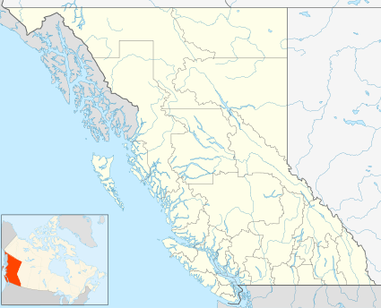 Spences Bridge Location of Spences Bridge in British Columbia | |
| Coordinates: 50°25′25″N 121°20′42″W | |
| Country | |
| Province | |
| Time zone | UTC-8 (PST) |
| • Summer (DST) | UTC-7 (PDT) |
History
.jpg)
The Kettle Valley Railway included a spur line stretching from Merritt to Spences Bridge. The rail bed is still intact, along with the original bridges.
On 1 January 2014, the old Spences Bridge, a one-lane steel truss bridge, was decommissioned and permanently closed to all pedestrian and vehicle traffic after 82 years of service. This was deemed necessary by British Columbia Ministry of Transportation and Infrastructure engineers due to the poor condition of the bridge.[3]
This settlement was originally known as Cook's Ferry because from 1862 to 1866 Mortimer Cook operated a ferry for crossing the river. The ferry was replaced by a toll bridge built by Thomas Spence under government contract.[4]:251
Locations
North of Spences Bridge is Ashcroft (44 km) and Cache Creek (50 km). Also north is 100 Mile House (162 km), Williams Lake (254 km), Quesnel (371 km), and Prince George (492 km). South of Spences Bridge is Lytton (35 km), Hope (143 km), and Vancouver (295 km). East of the town is Merritt (65 km) and Kelowna (192 km).
Spences Bridge's location is mountainous, with higher elevations part of the Interior Plateau. The east side of the Fraser here is part of the Clear Range, a mountainous southwards extension of the Fraser Plateau located in the angle of the Thompson and Fraser Rivers. Arthur Seat lies in that range on the west side of Spences Bridge, and was named by pioneer John Murray for the similarly-named mountain in Edinburgh, Scotland.[5]
Climate
Spences Bridge has a semi-arid climate (Köppen climate classification BSk). The climate is very dry and mild by Canadian standards, with an average annual precipitation of just 269.1 mm (10.6 in). Winters are short and moderately cold for usually brief periods and sunshine hours are very low for a couple of months, while summers are quite long, hot, sunny and dry – compared to the rest of Canada, albeit with comfortable nights. Like much of the lower-altitude valleys in the Thompson Nicola region, there are more days (on average approx. 40 days per year) when temperature exceeds 32 °C (90 °F) than remain below freezing.[6]
| Climate data for Spences Bridge | |||||||||||||
|---|---|---|---|---|---|---|---|---|---|---|---|---|---|
| Month | Jan | Feb | Mar | Apr | May | Jun | Jul | Aug | Sep | Oct | Nov | Dec | Year |
| Record high °C (°F) | 17.0 (62.6) |
17.5 (63.5) |
24.5 (76.1) |
32.0 (89.6) |
38.5 (101.3) |
39.5 (103.1) |
42.5 (108.5) |
40.5 (104.9) |
37.5 (99.5) |
31.0 (87.8) |
21.5 (70.7) |
17.5 (63.5) |
42.5 (108.5) |
| Average high °C (°F) | 0.7 (33.3) |
5.0 (41.0) |
12.4 (54.3) |
17.8 (64.0) |
22.3 (72.1) |
25.9 (78.6) |
29.6 (85.3) |
29.7 (85.5) |
24.2 (75.6) |
14.7 (58.5) |
5.9 (42.6) |
0.1 (32.2) |
15.7 (60.3) |
| Daily mean °C (°F) | −2.4 (27.7) |
0.8 (33.4) |
6.4 (43.5) |
11.0 (51.8) |
15.4 (59.7) |
19.1 (66.4) |
22.1 (71.8) |
22.1 (71.8) |
17.1 (62.8) |
9.5 (49.1) |
2.4 (36.3) |
−2.8 (27.0) |
10.1 (50.2) |
| Average low °C (°F) | −5.6 (21.9) |
−3.4 (25.9) |
0.4 (32.7) |
4.2 (39.6) |
8.4 (47.1) |
12.3 (54.1) |
14.6 (58.3) |
14.4 (57.9) |
10.0 (50.0) |
4.3 (39.7) |
−1.0 (30.2) |
−5.7 (21.7) |
4.4 (39.9) |
| Record low °C (°F) | −25.5 (−13.9) |
−23.0 (−9.4) |
−14.0 (6.8) |
−5.0 (23.0) |
−1.0 (30.2) |
4.0 (39.2) |
6.0 (42.8) |
6.0 (42.8) |
0.0 (32.0) |
−19.5 (−3.1) |
−29.0 (−20.2) |
−28.5 (−19.3) |
−29.0 (−20.2) |
| Average precipitation mm (inches) | 18.8 (0.74) |
12.4 (0.49) |
12.5 (0.49) |
13.8 (0.54) |
25.6 (1.01) |
29.6 (1.17) |
30.0 (1.18) |
22.2 (0.87) |
23.5 (0.93) |
22.1 (0.87) |
26.4 (1.04) |
27.0 (1.06) |
263.7 (10.38) |
| Average rainfall mm (inches) | 10.8 (0.43) |
10.0 (0.39) |
10.3 (0.41) |
13.8 (0.54) |
25.6 (1.01) |
29.6 (1.17) |
30.0 (1.18) |
22.2 (0.87) |
23.5 (0.93) |
21.7 (0.85) |
21.5 (0.85) |
14.5 (0.57) |
233.3 (9.19) |
| Average snowfall cm (inches) | 7.9 (3.1) |
2.4 (0.9) |
2.2 (0.9) |
0.0 (0.0) |
0.0 (0.0) |
0.0 (0.0) |
0.0 (0.0) |
0.0 (0.0) |
0.0 (0.0) |
0.4 (0.2) |
5.0 (2.0) |
12.5 (4.9) |
30.4 (12.0) |
| Average precipitation days (≥ 0.2 mm) | 6.7 | 5.6 | 5.6 | 4.6 | 6.9 | 7.6 | 6.7 | 5.6 | 6.0 | 6.9 | 9.5 | 7.4 | 79.0 |
| Average rainy days (≥ 0.2 mm) | 3.4 | 4.3 | 5.0 | 4.6 | 6.9 | 7.6 | 6.7 | 5.6 | 6.0 | 6.7 | 8.1 | 3.8 | 68.7 |
| Average snowy days (≥ 0.2 cm) | 3.6 | 1.4 | 0.7 | 0.0 | 0.0 | 0.0 | 0.0 | 0.0 | 0.0 | 0.2 | 1.7 | 4.1 | 11.7 |
| Source: [7] | |||||||||||||
Pioneers of Spences Bridge
- John Murray[8]
- James Teit (ethnographer)
- Archibald Clemes[9]
- Pierre Morens[10]
- Francoise Rey[11]
See also
- Fraser Canyon Gold Rush
- Cook's Ferry First Nation
- Cariboo Road
- Cariboo Gold Rush
- Thompson-Nicola Regional District
- Thompson River
- Clear Range
References
- http://www12.statcan.gc.ca/census-recensement/2016/dp-pd/prof/details/page.cfm?Lang=E&Geo1=DPL&Code1=590374&Geo2=PR&Code2=59&Data=Count&SearchText=Spences%20Bridge&SearchType=Begins&SearchPR=01&B1=All&GeoLevel=PR&GeoCode=590374&TABID=1
- Bowness, Lisanne (12 December 2013). "Aging Old Spences Bridge to be permanently closed". Government of British Columbia. Retrieved 8 November 2018.
- Akrigg, G.P.V.; Akrigg, Helen B. (1986), British Columbia Place Names (3rd, 1997 ed.), Vancouver: UBC Press, ISBN 0-7748-0636-2
- BC Names/GeoBC entry "Arthur Seat (mountain)"
- Environment Canada—Canadian Climate Normals 1971–2000, accessed 23 August 2012
- "Calculation Information for 1981 to 2010 Canadian Normals Data". Environment Canada. Retrieved 31 July 2016.
- http://www.quesnelmuseum.ca/GoldRushTrail/pg12.html
- http://www.quesnelmuseum.ca/GoldRushTrail/pg12.html
- http://www.michaelkluckner.com/bciw6spbrteit.html
- http://www.michaelkluckner.com/bciw6spbrteit.html
| Wikimedia Commons has media related to Spences Bridge. |