South Cinque Island
South Cinque Island or Ga-o-ta-koi[6] is an uninhabited island of the Andaman Islands. It belongs to the South Andaman administrative district, part of the Indian union territory of Andaman and Nicobar Islands.[7] The island lies 41 km (25 mi) south from Port Blair.
| Nickname: Ga-o-ta-koi | |
|---|---|
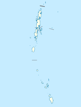
 South Cinque Island Location of South Cinque Island | |
| Geography | |
| Location | Bay of Bengal |
| Coordinates | 11.27°N 92.70°E |
| Archipelago | Andaman Islands |
| Adjacent bodies of water | Indian Ocean |
| Total islands | 1 |
| Major islands |
|
| Area | 4.557 km2 (1.759 sq mi)[1] |
| Length | 5.5 km (3.42 mi) |
| Width | 1.5 km (0.93 mi) |
| Coastline | 14 km (8.7 mi) |
| Highest elevation | 166 m (545 ft)[2] |
| Administration | |
| District | South Andaman |
| Island group | Andaman Islands |
| Island sub-group | Cinque Islands |
| Tehsil | Port Blair Tehsil |
| Demographics | |
| Population | 0 (2011) |
| Additional information | |
| Time zone | |
| PIN | 744202[3] |
| Telephone code | 031927 [4] |
| ISO code | IN-AN-00[5] |
| Official website | www |
Geography
The island belongs to the Cinque Islands of Rutland Archipelago and is located between North Cinque Island (1.5 km (1 mi) to the north) and Passage Island (6.2 km (4 mi) to the south). The passage between South Cinque and North Cinque is called Cinque Strait. South Cinque Island and North Cinque Island, 1.5 km (1 mi) to the north, are sometimes considered to be a single Cinque Island.
Administration
Politically, South Cinque Island is part of Port Blair Taluk.[8]
Fauna
A new species of blenny, Alloblennius frondiculus was found in the surrounding waters.[9]
References
- "Islandwise Area and Population - 2011 Census" (PDF). Government of Andaman.
- Sailing Directions (Enroute), Pub. 173: India and the Bay of Bengal (PDF). Sailing Directions. United States National Geospatial-Intelligence Agency. 2017. p. 288.
- "A&N Islands - Pincodes". 22 September 2016. Archived from the original on 23 March 2014. Retrieved 22 September 2016.
- "STD Codes of Andaman and Nicobar". allcodesindia.in. Retrieved 23 September 2016.
- Registration Plate Numbers added to ISO Code
- US Hydrographic Office (1916) Bay of bengal Pilot, page 288. H.O. pub. 160, Government Printing Office.
- "Village Code Directory: Andaman & Nicobar Islands" (PDF). Census of India. Retrieved 16 January 2011.
- "DEMOGRAPHIC – A&N ISLANDS" (PDF). andssw1.and.nic.in. Retrieved 23 September 2016.
- William F. Smith-Vaniz and Gerald R. Allen (2012), "Alloblennius frondiculus, a new species of blenny from the Andaman Islands (Teleostei: Blenniidae: Salariini)." Zootaxa, volume 3199, pages 60–65.
| Wikimedia Commons has media related to Rutland Island. |
