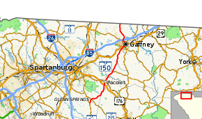
South Carolina Highway 150
South Carolina Highway 150 (SC 150) is a primary state highway in the U.S. state of South Carolina. The highway connects Pacolet and Gaffney with the more rural areas of Spartanburg and Cherokee counties.
| ||||
|---|---|---|---|---|
 | ||||
| Route information | ||||
| Maintained by SCDOT | ||||
| Length | 33.0 mi[1] (53.1 km) | |||
| Existed | 1940–present | |||
| Major junctions | ||||
| South end | ||||
| North end | ||||
| Location | ||||
| Counties | Spartanburg, Cherokee | |||
| Highway system | ||||
| ||||

Route description
SC 150 is a 33-mile (53 km) two-lane rural highway. In Gaffney, it goes through the downtown area along Limestone Street and overlaps with the Overmountain Victory National Historic Trail.
History
SC 150 was established in 1940 as a renumbering of part of SC 103, from SC 18 in Gaffney to the North Carolina state line.[2] In 1960-61, SC 150 was extended south to its current southern terminus at SC 56, replacing part of SC 18.[3][4]
Junction list
| County | Location | mi[1] | km | Destinations | Notes |
|---|---|---|---|---|---|
| Spartanburg | | 0.0 | 0.0 | ||
| Glenn Springs | 1.5 | 2.4 | |||
| Pacolet | 9.1 | 14.6 | |||
| 10.1 | 16.3 | ||||
| Cherokee | | 14.6 | 23.5 | ||
| Gaffney | 23.7 | 38.1 | North end of SC 105 overlap; to Gaffney Premium Outlets | ||
| 24.2 | 38.9 | South end of SC 105 overlap | |||
| 24.9 | 40.1 | ||||
| 25.0 | 40.2 | ||||
| 25.4 | 40.9 | ||||
| | 33.0 | 53.1 | Continuation beyond North Carolina state line | ||
1.000 mi = 1.609 km; 1.000 km = 0.621 mi
| |||||
gollark: The scanner/builder/composer can do a lot, but it's kind of difficult to understand and not well documented.
gollark: You can, ish.
gollark: Someone complained about their view, so I made it slate instead.
gollark: Which is fun too! I turned a random bit of mountain into endstone.
gollark: We only have the main RFTools mod.
References
- Google (August 16, 2015). "South Carolina Highway 150" (Map). Google Maps. Google. Retrieved August 16, 2015.
- General Highway Map, Cherokee County, South Carolina (PDF) (Map). Cartography by SCDOT. South Carolina Department of Transportation. 1940. Retrieved August 16, 2015.
- General Highway Map, Cherokee County, South Carolina (PDF) (Map). Cartography by SCDOT. South Carolina Department of Transportation. 1963. Retrieved August 16, 2015.
- General Highway Map, Spartanburg County, South Carolina (PDF) (Map). Cartography by SCDOT. South Carolina Department of Transportation. 1968. Retrieved August 16, 2015.
External links

- Mapmikey's South Carolina Highways Page: SC 150-159
This article is issued from Wikipedia. The text is licensed under Creative Commons - Attribution - Sharealike. Additional terms may apply for the media files.