Somerset station (SEPTA)
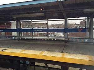
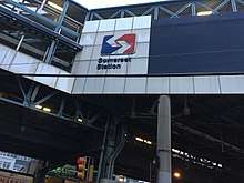
Somerset station is an elevated rapid transit station on SEPTA's Market–Frankford Line, located at the intersection of Somerset Street, D Street, and Kensington Avenue in the Kensington neighborhood of Philadelphia, Pennsylvania. The station is also served by SEPTA City Bus routes 3 and 54.
| SEPTA rapid transit station | |||||||||||
 Somerset station platform | |||||||||||
| Location | 2800 Kensington Avenue, Philadelphia, Pennsylvania | ||||||||||
| Coordinates | 39.9916°N 75.1222°W | ||||||||||
| Owned by | City of Philadelphia | ||||||||||
| Operated by | SEPTA | ||||||||||
| Platforms | 2 side platforms | ||||||||||
| Tracks | 2 | ||||||||||
| Connections | SEPTA City Bus: 3, 54, 89 | ||||||||||
| Construction | |||||||||||
| Structure type | Elevated | ||||||||||
| Disabled access | Yes | ||||||||||
| History | |||||||||||
| Opened | November 5, 1922[1] | ||||||||||
| Rebuilt | 1997[2] | ||||||||||
| Electrified | 700 volts DC third rail | ||||||||||
| Services | |||||||||||
| |||||||||||
| Location | |||||||||||
 Somerset Location within Philadelphia | |||||||||||
History
Somserset is part of the Frankford Elevated section of the line, which began service on November 5, 1922.[1][3][4][5]
Between 1988 and 2003, SEPTA undertook a $493.3 million reconstruction of the 5.5-mile (8.9 km) Frankford Elevated.[5] Somerset station was completely rebuilt on the site of the original station; the project included new platforms, elevators, windscreens, and overpasses, and the station now meets ADA accessibility requirements.[5] The line had originally been built with track ballast and was replaced with precast sections of deck, allowing the station (and the entire line) to remain open throughout the project.[6]
In 2007, Philadelphia Weekly named intersection underneath the station as one of the top ten "drug corners" in the city.[7]
During the Market–Frankford's rush-hour skip-stop service pattern, Somerset was only served by "B" trains. This practice was discontinued on February 24, 2020.[8][9]

Station layout
Access to the station is at the southwest corner of Somerset Street and Kensington Avenue. There is also an exit-only staircase from the eastbound platform at the southeast corner of the intersection. West of the station, the tracks traverse a truss bridge over a Conrail freight line.
| M | Mezzanine | Connection between platforms |
| P Platform level |
Side platform with fare control | |
| Westbound | ← Market–Frankford Line toward 69th Street (Huntingdon) | |
| Eastbound | Market–Frankford Line toward Frankford (Allegheny) → | |
| Side platform | ||
| G | Street level | Station house, buses |
References
- "Market-Frankford Subway–Elevated Line". SEPTA. Archived from the original on March 28, 2008. Retrieved June 4, 2020.
- "Frankford Elevated Rapid Rail Line". Wiss, Janney, Elstner Associates, Inc. Retrieved June 8, 2020.
- Cox, Harold E. (1967). May, Jack (ed.). The Road from Upper Darby. The Story of the Market Street Subway-Elevated. New York, NY: Electric Railroaders' Association. p. 17. OCLC 54770701.
- Hepp, John (2013). "Subways and Elevated Lines". Encyclopedia of Greater Philadelphia. Retrieved June 4, 2020.
- Edward L. Woods, Jr.; Thomas A. Nuxoll (1999). "The Frankford Elevated Reconstruction Project" (PDF). American Railway Engineering and Maintenance-of-Way Association. Retrieved June 4, 2020.
- American Public Transportation Association (1996). "Success Under Fire--A Discussion of the SEPTA-Frankford Elevated Reconstruction Project (FERP)". National Academies of Sciences, Engineering, and Medicine. Retrieved June 8, 2020.
- Volk, Steve (May 2, 2007). "Top 10 Drug Corners". Philadelphia Weekly. Archived from the original on September 7, 2012. Retrieved June 9, 2020.
- Ralph, Pat (February 24, 2020). "SEPTA service changes mark end of skip-stop service on Market-Frankford Line". PhillyVoice. Retrieved June 2, 2020.
- "SEPTA to Improve Market-Frankford Line Service Levels" (Press release). SEPTA. February 13, 2020. Retrieved June 2, 2020.
External links

- SEPTA – Somerset Station
- Images at NYCSubway.org
- Station entrance from Google Maps Street View
- Station exit from Google Maps Street View