Snelgrove, Ontario
Snelgrove is a historic community near Brampton, Ontario, Canada, straddling the border between Brampton and Caledon, and centred on the intersection of Hurontario Street and Mayfield Road. It was known as Edmonton in the 1800s after home town of local settlers.[1]
Snelgrove | |
|---|---|
Unincorporated community | |
| Coordinates: 43°44′02″N 79°49′28″W | |
| Country | Canada |
| Province | Ontario |
| Regional municipality | Peel |
| City | Brampton, Ontario |
| Time zone | UTC-5 (EST) |
| • Summer (DST) | UTC-4 (EDT) |
| Forward sortation area | L |
| Area code(s) | 905 and 289 |
| NTS Map | 030M12 |
| GNBC Code | FCPSS |
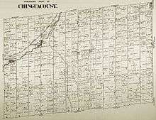
The area's boundaries creates a deviation of the border with Caledon which is bisected by Mayfield Road, to include the entire community within Brampton: the western end at the Orangeville Brampton Railway railway tracks west of Robertson Davies Drive, northern end just north of Collingwood Road / Highwood Road, eastern end just east of Etobicoke Creek. Previously known as Edmonton, it was renamed in 1880s by Canadian Pacific Railway to avoid confusion with another CPR stop in what is now Edmonton, Alberta. The area's name is linked to the local Snell family (lead by John Snell and brothers whom settled in Chinguacucy Township in 1838).[1]
When Hurricane Hazel struck Ontario in 1954, Snelgrove received the most rainfall of any Canadian location, with 214 mm (8.4 in) of rain.[2]
Highway 410 has been extended to a new terminus in Snelgrove, at Hurontario Street, just north of Mayfield Road.
Among others, businesses in Snelgrove include a Shoppers Drug Mart, Sobeys, Tim Hortons and the Snelgrove Veterinary Clinic.
The Canadian Pacific Railway (previously Credit Valley Railway) line from Streetsville to Owen Sound passed through Snelgrove, and there was a station for passenger trains. Today all that is left of the site is a few railway sidings that shortline operator Orangeville Brampton Railway occasionally uses.
References
- "Heritage Report: Reasons for Heritage Designation" (PDF). Brampton Heritage Board. January 21, 2014. Retrieved May 30, 2020.
- Peter Bowyer (2004). "Storm information". Canadian Hurricane Centre. Retrieved July 12, 2010.
External links
- Snelgrove at Geographical Names of Canada