Slovakia–Ukraine border
The Slovakia–Ukraine border is an internationally established boundary between Slovakia and Ukraine. Both countries inherited it from their previous respective state organizations, Ukraine from the Soviet Union and Slovakia from Czechoslovakia.
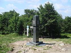
Typical border marker of Ukraine
Slovak, Polish and Ukrainian border tripoint
The current border was established after World War II and stretches for 97 km (60 mi). After admission of Slovakia to the European Union the border security became the responsibility of the Union, as well.
Border checkpoints
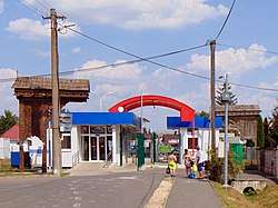
Slovak-Ukrainian border, crossing-point Veľké Slemence - Mali Selmentsi; Slovak side.
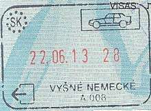
Exit passport stamp issued at the border crossing point in Vyšné Nemecké.
- Road
| Uzhhorod | M08 | Vyšné Nemecké | 48.655749°N 22.265296°E | |||
| Malyi Bereznyi | P53/74 | Ubľa | only for vehicles with maximal permissible weight up to 3.5 tons | 48.883937°N 22.420478°E |
- Rail
| Uzhhorod | — | Veľké Kapušany | freight only | ||
| Chop | — | Čierna nad Tisou |
- Others
| Mali Selmentsi | — | Veľké Slemence | pedestrian, bicycle | 48.511125°N 22.154290°E | ||
| Pavlove | — | Maťovské Vojkovce |
In 2008 the border was crossed by some 2.8 million people and over 1.5 million transportation objects.[1]
gollark: But with advances in deep learning nowadays, and my extremely large dataset of "good" memes, I could probably autofilter them.
gollark: See, it is very easy to obtain vast quantities of memes, by crawling reddit. Unfortunately, they're mostly bad.
gollark: Automated memeCLOUD™ meme harvesting.
gollark: I have recently had an idea which MAY actually be practical.
gollark: GIF is not good for videos and has not been extended to be better.
External links
This article is issued from Wikipedia. The text is licensed under Creative Commons - Attribution - Sharealike. Additional terms may apply for the media files.