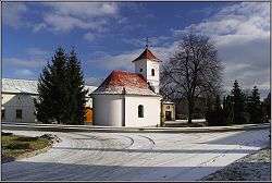
Slatinky
Slatinky is a village and municipality (obec) in Prostějov District in the Olomouc Region of the Czech Republic.
Slatinky | |
|---|---|
Municipality | |
 | |
 Coat of arms | |
 Slatinky | |
| Coordinates: 49°32′53″N 17°5′13″E | |
| Country | |
| Region | Olomouc |
| District | Prostějov |
| Area | |
| • Total | 8.02 km2 (3.10 sq mi) |
| Elevation | 272 m (892 ft) |
| Population (2006) | |
| • Total | 492 |
| • Density | 61/km2 (160/sq mi) |
| Postal code | 783 42 |
| Website | http://slatinky.cz |
The municipality covers an area of 8.02 square kilometres (3.10 sq mi), and has a population of 492 (as at 28 August 2006).
Slatinky lies approximately 9 kilometres (6 mi) north of Prostějov, 13 km (8 mi) south-west of Olomouc, and 201 km (125 mi) east of Prague.
There is a natural monument Vápenice in the southern part of the territory of the municipality.[1]
Notes
- "PP Vápenice". Ústřední seznam ochrany přírody. Nature Conservation Agency of the Czech Republic (AOPK ČR). Retrieved 2014-05-02.
gollark: You have choices. Like other jobs. Or other industries.
gollark: It's like only buying blue machines for your factory. It costs money versus not caring.
gollark: I mean, reduction of racism is... probably good for the economy... not bad as you seem to have implied.
gollark: And it isn't be current majority views, which would be bad enough, but current loud people views.
gollark: If we just encoded current beliefs into law all the time, it would be harder to change them.
This article is issued from Wikipedia. The text is licensed under Creative Commons - Attribution - Sharealike. Additional terms may apply for the media files.