Siripuram, Guntur district
Siripuram is a village in Guntur district of the Indian state of Andhra Pradesh. It is located in Medikonduru mandal of Guntur revenue division.[2]
Siripuram | |
|---|---|
Village | |
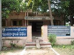 Gram panchayat office in Siripuram | |
.svg.png) Siripuram Location in Andhra Pradesh, India | |
| Coordinates: 16.18°N 80.29°E | |
| Country | India |
| State | Andhra Pradesh |
| District | Guntur |
| Mandal | Medikonduru |
| Government | |
| • Type | Panchayati raj |
| • Body | Siripuram gram panchayat |
| Area | |
| • Total | 1,641 ha (4,055 acres) |
| Population (2011)[3] | |
| • Total | 8,766 |
| • Density | 530/km2 (1,400/sq mi) |
| Languages | |
| • Official | Telugu |
| Time zone | UTC+5:30 (IST) |
| PIN | 522401 |
| Area code(s) | +91–863 |
| Vehicle registration | AP |
Geography
Siripuram is situated to the north of the mandal headquarters, Medikonduru,[4] at 16.18°N 80.29°E. It is spread over an area of 1,641 ha (4,050 acres).[2]
Governance
Siripuram gram panchayat is the local self-government of the village.[1] It is divided into wards and each ward is represented by a ward member.[5] The village forms a part of Andhra Pradesh Capital Region and is under the jurisdiction of APCRDA.[6]
Education
As per the school information report for the academic year 2018–19, the village has a total of 13 schools. These include 8 Zilla Parishad/MPP and 5 private schools.[7]
gollark: Yes, destroy the moon.
gollark: Yes, I too enjoy shutting down some important bits of my brain and probably breaking my liver slightly.
gollark: Being drunk sounds highly uncool.
gollark: And if there was an RKKV heading for us, we also probably wouldn't be able to detect it.
gollark: If a gamma ray burst was coming toward us, we probably wouldn't be able to detect it.
See also
References
- "Gram Panchayat Identification Codes" (PDF). Saakshar Bharat Mission. National Informatics Centre. p. 108. Archived from the original (PDF) on 18 August 2017. Retrieved 7 May 2019.
- "District Census Hand Book : Guntur (Part B)" (PDF). Census of India. Directorate of Census Operations, Andhra Pradesh. 2011. pp. 14, 378. Retrieved 11 June 2019.
- "Population". Census of India. Registrar General and Census Commissioner of India. Retrieved 8 May 2019.
- "District Census Handbook : Guntur (Part A)" (PDF). Census of India. Directorate of Census Operations, Andhra Pradesh. 2011. pp. 5, 590–591. Retrieved 5 June 2019.
- Seetharam, Mukkavilli (1 January 1990). Citizen Participation in Rural Development. Mittal Publications. p. 34. ISBN 9788170992271.
- "Declaration of A.P. Capital Region" (PDF). Andhra Pradesh Capital Region Development Authority. Municipal Administration and Urban Development Department, Andhra Pradesh. 30 December 2014. p. 4. Archived (PDF) from the original on 11 May 2019. Retrieved 14 May 2019.
- "School Information". Commissionerate of School Education. Government of Andhra Pradesh. Retrieved 7 May 2019.
| Wikimedia Commons has media related to Siripuram. |
This article is issued from Wikipedia. The text is licensed under Creative Commons - Attribution - Sharealike. Additional terms may apply for the media files.