Simmons Peak (Tuolumne Meadows)
Simmons Peak is a mountain, in the Tuolumne Meadows region of Yosemite National Park. In difficulty, its routes range from scrambling to class 4. It is a few miles north of Mount Lyell.[2]
| Simmons Peak | |
|---|---|
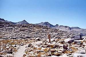
 The sign marking the top of Donohue Pass, looking from the John Muir Wilderness/Inyo National Forest side toward the Yosemite side, with a few peaks of the Cathedral Range in the background, including Simmons Peak. | |
| Highest point | |
| Elevation | 12,567 ft (3,830 m) NAVD 88[1] |
| Prominence | 377 ft (115 m) [1] |
| Parent peak | Mount Maclure |
| Coordinates | 37°45′39″N 119°17′40″W [1] |
| Geography | |
 Simmons Peak  Simmons Peak | |
| Location | Madera and Tuolumne counties, California, U.S. |
| Parent range | Ritter Range, Cathedral Range; Sierra Nevada |
| Topo map | USGS Mount Florence, California |
| Climbing | |
| First ascent | Al Steck and George Steck |
| Easiest route | scramble to class 4"Simmons Peak". SummitPost.org. |
Simmons Peak is the 12th-highest mountain in Yosemite, if not often climbed, partially due to its not being on the Sierra Club's Sierra Peaks Section SPS List.[3]
Near to Simmons Peak
All of the following are near, to Simmons Peak:[4]
- Parsons Peak 1.3 miles (2.1 km)
- Mount Maclure 1.4 miles (2.3 km)
- Amelia Earhart Peak 1.8 miles (2.9 km)
- Mount Florence 1.9 miles (3.1 km)
- Mount Lyell 1.9 miles (3.1 km)
gollark: XXXII cervisia stultus est aliquantulus.
gollark: std::cout << "admittedly this is just English wrapped in Cplusplus\n";
gollark: Why speak English when you can speak C++?
gollark: Yes, Ï SÄÏD IT.
gollark: English is a knockoff of Proto-Germanic.
References
- "Simmons Peak, California". Peakbagger.com. Retrieved 2019-02-24.
- Mrchad9. "Simmons Peak". summitpost.org. Retrieved 24 February 2019.
- Mrchad9. "Yosemite's Highest Peaks". summitpost.org. Retrieved 24 February 2019.
- "Simmons Peak, Part of Yosemite National Park". anyplaceamerica.com. 2016. Retrieved 24 February 2019.
External links and references
This article is issued from Wikipedia. The text is licensed under Creative Commons - Attribution - Sharealike. Additional terms may apply for the media files.