Silverdale, Auckland
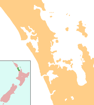
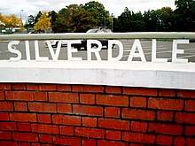
Silverdale is a village approximately 30 km north of Auckland in the North Island of New Zealand. It is located on the north bank of the Weiti River and lies to the west of the Whangaparaoa Peninsula. It was formerly called Wade (a corruption of Weiti) but renamed Silverdale in 1911 because of the many poplar trees in the area at the time and because it is situated in a dale.[1]
Silverdale | |
|---|---|
 Silverdale | |
| Coordinates: 36°37′9″S 174°40′37″E | |
| Country | |
| Region | Auckland |
| Territorial authority | Auckland Council |
| Ward | Albany ward |
| Population (2018) | |
| • Total | 2,283 |
State Highway 1 passes to the west of the village via the Northern Motorway. The former route of State Highway 1 runs south-west to north-east through the village. This route was redesignated State Highway 17 before being redesignated Hibiscus Coast Highway (part of Urban Route 31). This passes through Orewa and Waiwera before joining State Highway 1 at the termination of the motorway south of Puhoi.
Hibiscus Coast Busway Station is the northernmost station participating in the Northern Busway. It is located on the Hibiscus Coast Highway a few hundred metres south-west of Silverdale.[2]
Demographics
| Year | Pop. | ±% p.a. |
|---|---|---|
| 2006 | 1,824 | — |
| 2013 | 2,085 | +1.93% |
| 2018 | 2,283 | +1.83% |
| Source: [3] | ||

Silverdale (comprising the statistical areas of Silverdale Central (Auckland) and Silverdale South (Auckland)) had a population of 2,283 at the 2018 New Zealand census, an increase of 198 people (9.5%) since the 2013 census, and an increase of 459 people (25.2%) since the 2006 census. There were 756 households. There were 1,188 males and 1,095 females, giving a sex ratio of 1.08 males per female, with 411 people (18.0%) aged under 15 years, 414 (18.1%) aged 15 to 29, 1,212 (53.1%) aged 30 to 64, and 240 (10.5%) aged 65 or older.
Ethnicities were 86.6% European/Pākehā, 7.8% Māori, 1.4% Pacific peoples, 9.5% Asian, and 2.4% other ethnicities (totals add to more than 100% since people could identify with multiple ethnicities).
The proportion of people born overseas was 32.3%, compared with 27.1% nationally.
Although some people objected to giving their religion, 60.3% had no religion, 29.6% were Christian, and 3.7% had other religions.
Of those at least 15 years old, 402 (21.5%) people had a bachelor or higher degree, and 234 (12.5%) people had no formal qualifications. The employment status of those at least 15 was that 1,113 (59.5%) people were employed full-time, 294 (15.7%) were part-time, and 48 (2.6%) were unemployed.[3]
Education
Silverdale School is a full primary (years 1–8) school with a roll of 730 students as at March 2020.[4][5] The school was founded in 1869[6] and moved to its current site at the end of 2006.[7]
Stella Maris Primary School is a state integrated full primary (years 1–8) school with a roll of 269 students as at March 2020.[4][8] The Catholic school opened at the beginning of 2005.[9]
Both schools are coeducational.
References
- Wises New Zealand Guide, 7th Edition, 1979. p. 397
- "What are the names and locations of the bus stations?". Auckland Transport – at.govt.nz. Retrieved 22 July 2017.
- "Statistical area 1 dataset for 2018 Census". Statistics New Zealand. March 2020. Silverdale Central (Auckland) (113800) and Silverdale South (Auckland) (114100). 2018 Census place summary: Silverdale Central (Auckland) 2018 Census place summary: Silverdale South (Auckland)
- "New Zealand Schools Directory". New Zealand Ministry of Education. Retrieved 26 April 2020.
- Education Counts: Silverdale School
- "Special Features of Silverdale School". Silverdale School. Retrieved 26 August 2008.
- "Education Review Report – Silverdale School". Education Review Office. February 2006. Retrieved 26 August 2008.
- Education Counts: Stella Maris Primary School
- "Foundation". Stella Maris Primary School. Archived from the original on 14 October 2008. Retrieved 26 August 2008.